You are here: Home > Network List > TA - USArray Transportable Network (new EarthScope stations) Stations List
> Station I30M Mount Dempster, Yukon, CAN > Earthquake Result Viewer
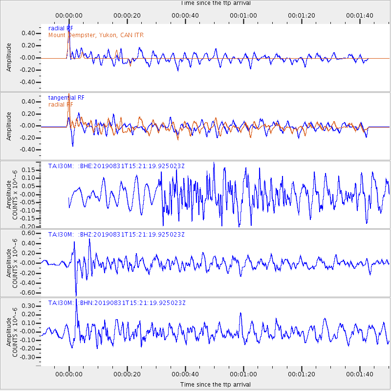
I30M Mount Dempster, Yukon, CAN - Earthquake Result Viewer
*The percent match for this event was below the threshold and hence no stack was calculated.
| Earthquake location: |
Myanmar |
| Earthquake latitude/longitude: |
22.7/95.5 |
| Earthquake time(UTC): |
2019/08/31 (243) 15:09:22 GMT |
| Earthquake Depth: |
10 km |
| Earthquake Magnitude: |
5.5 Mww |
| Earthquake Catalog/Contributor: |
NEIC PDE/us |
|
| Network: |
TA USArray Transportable Network (new EarthScope stations) |
| Station: |
I30M Mount Dempster, Yukon, CAN |
| Lat/Lon: |
65.22 N/136.38 W |
| Elevation: |
1399 m |
|
| Distance: |
83.8 deg |
| Az: |
19.488 deg |
| Baz: |
313.047 deg |
| Ray Param: |
$rayparam |
*The percent match for this event was below the threshold and hence was not used in the summary stack. |
|
| Radial Match: |
64.00722 % |
| Radial Bump: |
400 |
| Transverse Match: |
69.737206 % |
| Transverse Bump: |
398 |
| SOD ConfigId: |
19053131 |
| Insert Time: |
2019-09-14 15:16:34.171 +0000 |
| GWidth: |
2.5 |
| Max Bumps: |
400 |
| Tol: |
0.001 |
|
Signal To Noise
| Channel | StoN | STA | LTA |
| TA:I30M: :BHZ:20190831T15:21:19.925023Z | 5.7752347 | 2.2276438E-7 | 3.8572352E-8 |
| TA:I30M: :BHN:20190831T15:21:19.925023Z | 2.5554943 | 1.371601E-7 | 5.3672633E-8 |
| TA:I30M: :BHE:20190831T15:21:19.925023Z | 1.4525362 | 7.5585106E-8 | 5.2036643E-8 |
| Arrivals |
| Ps | |
| PpPs | |
| PsPs/PpSs | |


