You are here: Home > Network List > TA - USArray Transportable Network (new EarthScope stations) Stations List
> Station J20K Nowitna River, AK, USA > Earthquake Result Viewer
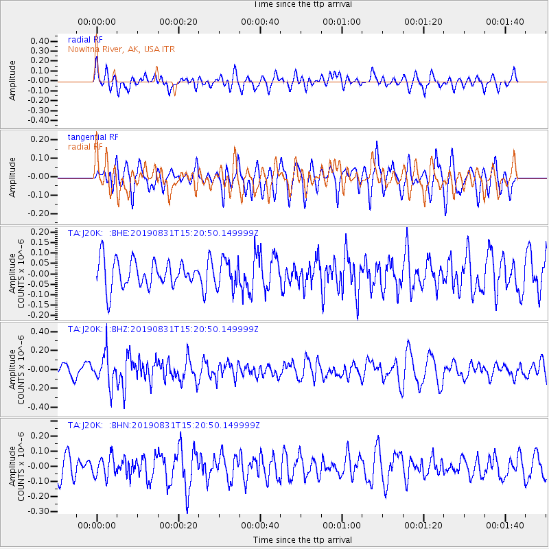
J20K Nowitna River, AK, USA - Earthquake Result Viewer
*The percent match for this event was below the threshold and hence no stack was calculated.
| Earthquake location: |
Myanmar |
| Earthquake latitude/longitude: |
22.7/95.5 |
| Earthquake time(UTC): |
2019/08/31 (243) 15:09:22 GMT |
| Earthquake Depth: |
10 km |
| Earthquake Magnitude: |
5.5 Mww |
| Earthquake Catalog/Contributor: |
NEIC PDE/us |
|
| Network: |
TA USArray Transportable Network (new EarthScope stations) |
| Station: |
J20K Nowitna River, AK, USA |
| Lat/Lon: |
64.18 N/154.15 W |
| Elevation: |
314 m |
|
| Distance: |
78.2 deg |
| Az: |
24.811 deg |
| Baz: |
297.815 deg |
| Ray Param: |
$rayparam |
*The percent match for this event was below the threshold and hence was not used in the summary stack. |
|
| Radial Match: |
40.256367 % |
| Radial Bump: |
400 |
| Transverse Match: |
43.136276 % |
| Transverse Bump: |
400 |
| SOD ConfigId: |
19053131 |
| Insert Time: |
2019-09-14 15:16:35.801 +0000 |
| GWidth: |
2.5 |
| Max Bumps: |
400 |
| Tol: |
0.001 |
|
Signal To Noise
| Channel | StoN | STA | LTA |
| TA:J20K: :BHZ:20190831T15:20:50.149999Z | 2.435183 | 1.6312241E-7 | 6.6985685E-8 |
| TA:J20K: :BHN:20190831T15:20:50.149999Z | 0.77279526 | 6.934976E-8 | 8.973885E-8 |
| TA:J20K: :BHE:20190831T15:20:50.149999Z | 1.0343369 | 6.657989E-8 | 6.436963E-8 |
| Arrivals |
| Ps | |
| PpPs | |
| PsPs/PpSs | |


