You are here: Home > Network List > TA - USArray Transportable Network (new EarthScope stations) Stations List
> Station J26L Joseph Creek, AK, USA > Earthquake Result Viewer
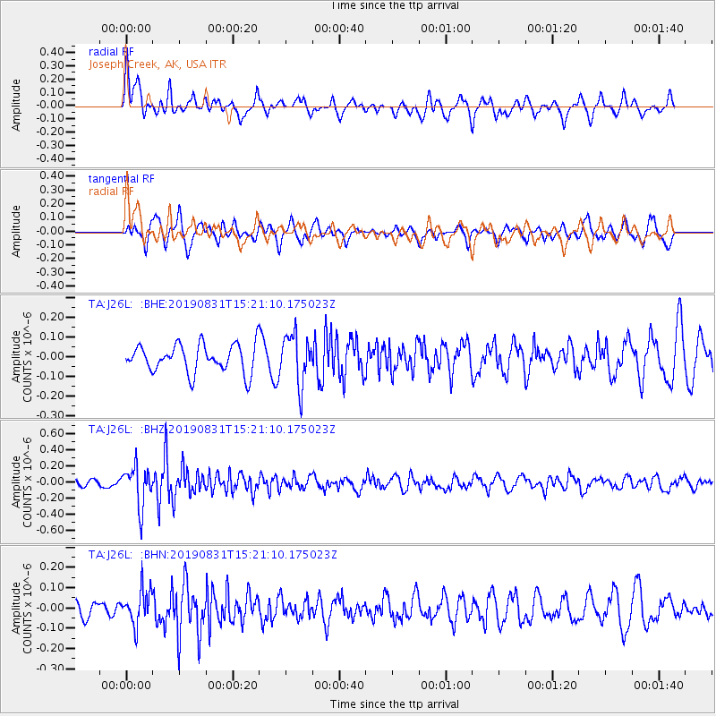
J26L Joseph Creek, AK, USA - Earthquake Result Viewer
*The percent match for this event was below the threshold and hence no stack was calculated.
| Earthquake location: |
Myanmar |
| Earthquake latitude/longitude: |
22.7/95.5 |
| Earthquake time(UTC): |
2019/08/31 (243) 15:09:22 GMT |
| Earthquake Depth: |
10 km |
| Earthquake Magnitude: |
5.5 Mww |
| Earthquake Catalog/Contributor: |
NEIC PDE/us |
|
| Network: |
TA USArray Transportable Network (new EarthScope stations) |
| Station: |
J26L Joseph Creek, AK, USA |
| Lat/Lon: |
64.50 N/143.56 W |
| Elevation: |
1144 m |
|
| Distance: |
81.9 deg |
| Az: |
22.033 deg |
| Baz: |
306.865 deg |
| Ray Param: |
$rayparam |
*The percent match for this event was below the threshold and hence was not used in the summary stack. |
|
| Radial Match: |
55.949753 % |
| Radial Bump: |
400 |
| Transverse Match: |
51.690598 % |
| Transverse Bump: |
400 |
| SOD ConfigId: |
19053131 |
| Insert Time: |
2019-09-14 15:16:37.803 +0000 |
| GWidth: |
2.5 |
| Max Bumps: |
400 |
| Tol: |
0.001 |
|
Signal To Noise
| Channel | StoN | STA | LTA |
| TA:J26L: :BHZ:20190831T15:21:10.175023Z | 3.651664 | 2.501805E-7 | 6.851137E-8 |
| TA:J26L: :BHN:20190831T15:21:10.175023Z | 1.5872343 | 8.5933195E-8 | 5.414021E-8 |
| TA:J26L: :BHE:20190831T15:21:10.175023Z | 1.7930975 | 1.265985E-7 | 7.060324E-8 |
| Arrivals |
| Ps | |
| PpPs | |
| PsPs/PpSs | |


