You are here: Home > Network List > TA - USArray Transportable Network (new EarthScope stations) Stations List
> Station R33M Jennings River, BC, CAN > Earthquake Result Viewer
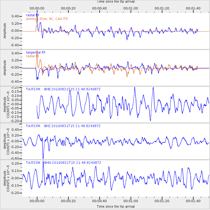
R33M Jennings River, BC, CAN - Earthquake Result Viewer
*The percent match for this event was below the threshold and hence no stack was calculated.
| Earthquake location: |
Myanmar |
| Earthquake latitude/longitude: |
22.7/95.5 |
| Earthquake time(UTC): |
2019/08/31 (243) 15:09:22 GMT |
| Earthquake Depth: |
10 km |
| Earthquake Magnitude: |
5.5 Mww |
| Earthquake Catalog/Contributor: |
NEIC PDE/us |
|
| Network: |
TA USArray Transportable Network (new EarthScope stations) |
| Station: |
R33M Jennings River, BC, CAN |
| Lat/Lon: |
59.39 N/130.97 W |
| Elevation: |
1437 m |
|
| Distance: |
89.7 deg |
| Az: |
21.784 deg |
| Baz: |
317.968 deg |
| Ray Param: |
$rayparam |
*The percent match for this event was below the threshold and hence was not used in the summary stack. |
|
| Radial Match: |
62.72044 % |
| Radial Bump: |
400 |
| Transverse Match: |
68.1365 % |
| Transverse Bump: |
400 |
| SOD ConfigId: |
19053131 |
| Insert Time: |
2019-09-14 15:17:01.988 +0000 |
| GWidth: |
2.5 |
| Max Bumps: |
400 |
| Tol: |
0.001 |
|
Signal To Noise
| Channel | StoN | STA | LTA |
| TA:R33M: :BHZ:20190831T15:21:48.824987Z | 2.6652634 | 2.2293774E-7 | 8.3645666E-8 |
| TA:R33M: :BHN:20190831T15:21:48.824987Z | 1.699393 | 1.03792345E-7 | 6.107612E-8 |
| TA:R33M: :BHE:20190831T15:21:48.824987Z | 1.12594 | 8.800585E-8 | 7.816211E-8 |
| Arrivals |
| Ps | |
| PpPs | |
| PsPs/PpSs | |


