You are here: Home > Network List > UW - Pacific Northwest Regional Seismic Network Stations List
> Station UMAT Pilot Rock, OR, USA > Earthquake Result Viewer
UMAT Pilot Rock, OR, USA - Earthquake Result Viewer
*The percent match for this event was below the threshold and hence no stack was calculated.
| Earthquake location: |
Southern East Pacific Rise |
| Earthquake latitude/longitude: |
-49.9/-114.9 |
| Earthquake time(UTC): |
2019/09/01 (244) 02:34:50 GMT |
| Earthquake Depth: |
10 km |
| Earthquake Magnitude: |
5.5 Mww |
| Earthquake Catalog/Contributor: |
NEIC PDE/us |
|
| Network: |
UW Pacific Northwest Regional Seismic Network |
| Station: |
UMAT Pilot Rock, OR, USA |
| Lat/Lon: |
45.29 N/118.96 W |
| Elevation: |
1318 m |
|
| Distance: |
94.9 deg |
| Az: |
357.156 deg |
| Baz: |
177.395 deg |
| Ray Param: |
$rayparam |
*The percent match for this event was below the threshold and hence was not used in the summary stack. |
|
| Radial Match: |
56.572716 % |
| Radial Bump: |
400 |
| Transverse Match: |
60.326702 % |
| Transverse Bump: |
285 |
| SOD ConfigId: |
19053131 |
| Insert Time: |
2019-09-15 02:42:33.246 +0000 |
| GWidth: |
2.5 |
| Max Bumps: |
400 |
| Tol: |
0.001 |
|
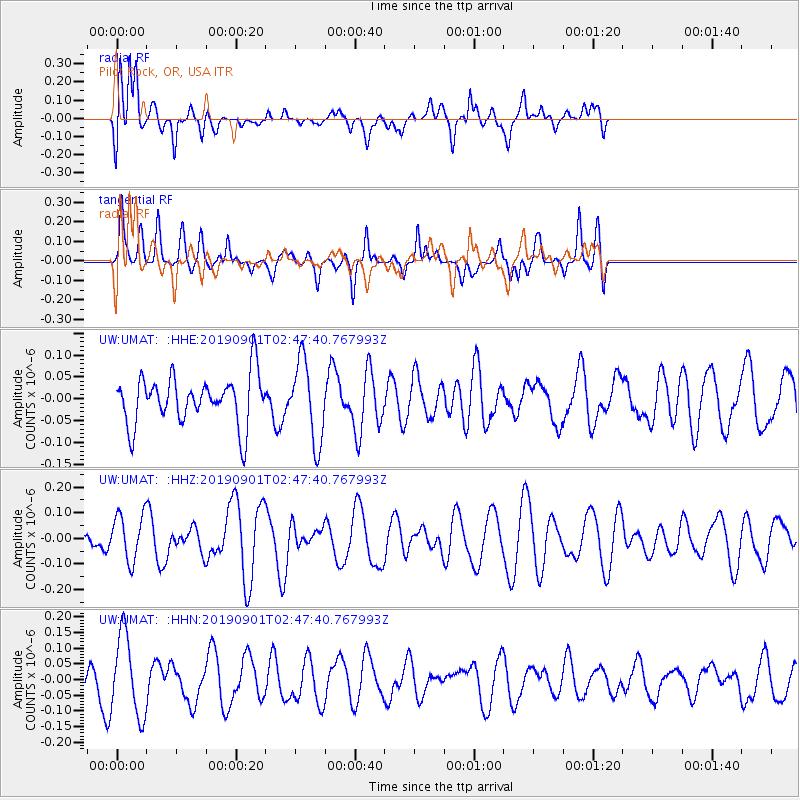
Signal To Noise
| Channel | StoN | STA | LTA |
| UW:UMAT: :HHZ:20190901T02:47:40.767993Z | 1.6109158 | 9.04427E-8 | 5.614365E-8 |
| UW:UMAT: :HHN:20190901T02:47:40.767993Z | 2.8615932 | 1.291458E-7 | 4.5130733E-8 |
| UW:UMAT: :HHE:20190901T02:47:40.767993Z | 1.6584226 | 9.26356E-8 | 5.585766E-8 |
| Arrivals |
| Ps | |
| PpPs | |
| PsPs/PpSs | |


