You are here: Home > Network List > AV - Alaska Volcano Observatory Stations List
> Station SPCR Ckakachatna River, Mount Spurr, Alaska > Earthquake Result Viewer
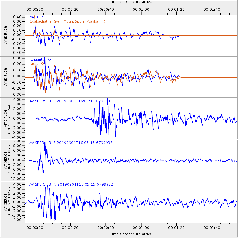
SPCR Ckakachatna River, Mount Spurr, Alaska - Earthquake Result Viewer
*The percent match for this event was below the threshold and hence no stack was calculated.
| Earthquake location: |
Fiji Islands Region |
| Earthquake latitude/longitude: |
-20.4/-178.4 |
| Earthquake time(UTC): |
2019/09/01 (244) 15:54:20 GMT |
| Earthquake Depth: |
617 km |
| Earthquake Magnitude: |
6.5 Mi |
| Earthquake Catalog/Contributor: |
NEIC PDE/at |
|
| Network: |
AV Alaska Volcano Observatory |
| Station: |
SPCR Ckakachatna River, Mount Spurr, Alaska |
| Lat/Lon: |
61.20 N/152.21 W |
| Elevation: |
984 m |
|
| Distance: |
84.0 deg |
| Az: |
12.41 deg |
| Baz: |
204.601 deg |
| Ray Param: |
$rayparam |
*The percent match for this event was below the threshold and hence was not used in the summary stack. |
|
| Radial Match: |
72.70446 % |
| Radial Bump: |
400 |
| Transverse Match: |
80.16707 % |
| Transverse Bump: |
400 |
| SOD ConfigId: |
19053131 |
| Insert Time: |
2019-09-15 15:58:19.042 +0000 |
| GWidth: |
2.5 |
| Max Bumps: |
400 |
| Tol: |
0.001 |
|
Signal To Noise
| Channel | StoN | STA | LTA |
| AV:SPCR: :BHZ:20190901T16:05:15.679993Z | 14.091229 | 3.2693372E-6 | 2.3201221E-7 |
| AV:SPCR: :BHN:20190901T16:05:15.679993Z | 2.860503 | 8.971538E-7 | 3.1363498E-7 |
| AV:SPCR: :BHE:20190901T16:05:15.679993Z | 2.5476172 | 6.594172E-7 | 2.5883685E-7 |
| Arrivals |
| Ps | |
| PpPs | |
| PsPs/PpSs | |


