You are here: Home > Network List > TS - TERRAscope (Southern California Seismic Network) Stations List
> Station MLAC Mammoth Lakes, California, USA > Earthquake Result Viewer
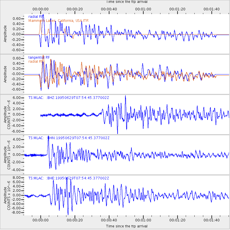
MLAC Mammoth Lakes, California, USA - Earthquake Result Viewer
*The percent match for this event was below the threshold and hence no stack was calculated.
| Earthquake location: |
Kuril Islands |
| Earthquake latitude/longitude: |
48.8/154.5 |
| Earthquake time(UTC): |
1995/06/29 (180) 07:45:09 GMT |
| Earthquake Depth: |
62 km |
| Earthquake Magnitude: |
5.9 MB, 6.0 UNKNOWN, 6.0 MW |
| Earthquake Catalog/Contributor: |
WHDF/NEIC |
|
| Network: |
TS TERRAscope (Southern California Seismic Network) |
| Station: |
MLAC Mammoth Lakes, California, USA |
| Lat/Lon: |
37.63 N/118.83 W |
| Elevation: |
2170 m |
|
| Distance: |
60.9 deg |
| Az: |
65.1 deg |
| Baz: |
310.92 deg |
| Ray Param: |
$rayparam |
*The percent match for this event was below the threshold and hence was not used in the summary stack. |
|
| Radial Match: |
84.69936 % |
| Radial Bump: |
400 |
| Transverse Match: |
83.145836 % |
| Transverse Bump: |
400 |
| SOD ConfigId: |
4480 |
| Insert Time: |
2010-02-26 14:27:51.785 +0000 |
| GWidth: |
2.5 |
| Max Bumps: |
400 |
| Tol: |
0.001 |
|
Signal To Noise
| Channel | StoN | STA | LTA |
| TS:MLAC: :BHN:19950629T07:54:45.377002Z | 6.937092 | 1.4954906E-6 | 2.155789E-7 |
| TS:MLAC: :BHE:19950629T07:54:45.377002Z | 0.8213594 | 2.7256436E-7 | 3.3184543E-7 |
| TS:MLAC: :BHZ:19950629T07:54:45.377002Z | 1.3056383 | 3.1090855E-7 | 2.3812761E-7 |
| Arrivals |
| Ps | |
| PpPs | |
| PsPs/PpSs | |


