You are here: Home > Network List > CN - Canadian National Seismograph Network Stations List
> Station INK INUVIK, NT > Earthquake Result Viewer
INK INUVIK, NT - Earthquake Result Viewer
*The percent match for this event was below the threshold and hence no stack was calculated.
| Earthquake location: |
Fiji Islands Region |
| Earthquake latitude/longitude: |
-20.4/-178.4 |
| Earthquake time(UTC): |
2019/09/01 (244) 15:54:20 GMT |
| Earthquake Depth: |
617 km |
| Earthquake Magnitude: |
6.5 Mi |
| Earthquake Catalog/Contributor: |
NEIC PDE/at |
|
| Network: |
CN Canadian National Seismograph Network |
| Station: |
INK INUVIK, NT |
| Lat/Lon: |
68.31 N/133.53 W |
| Elevation: |
44 m |
|
| Distance: |
94.3 deg |
| Az: |
15.251 deg |
| Baz: |
221.582 deg |
| Ray Param: |
$rayparam |
*The percent match for this event was below the threshold and hence was not used in the summary stack. |
|
| Radial Match: |
68.15192 % |
| Radial Bump: |
382 |
| Transverse Match: |
54.700024 % |
| Transverse Bump: |
400 |
| SOD ConfigId: |
19053131 |
| Insert Time: |
2019-09-15 16:00:03.271 +0000 |
| GWidth: |
2.5 |
| Max Bumps: |
400 |
| Tol: |
0.001 |
|
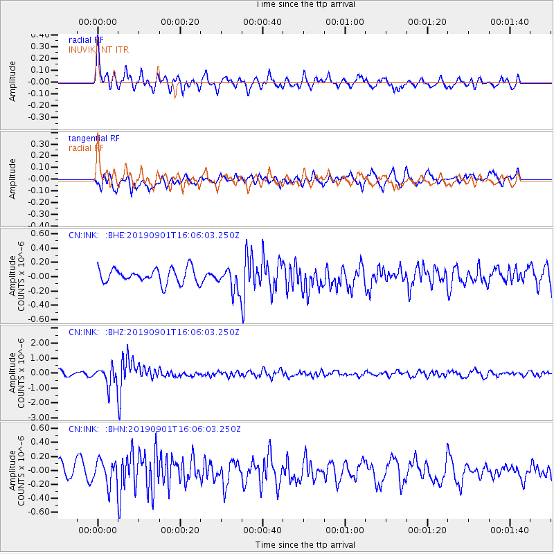
Signal To Noise
| Channel | StoN | STA | LTA |
| CN:INK: :BHZ:20190901T16:06:03.250Z | 4.337974 | 6.7232446E-7 | 1.5498581E-7 |
| CN:INK: :BHN:20190901T16:06:03.250Z | 1.2558085 | 1.8541171E-7 | 1.476433E-7 |
| CN:INK: :BHE:20190901T16:06:03.250Z | 1.6798234 | 1.705276E-7 | 1.015152E-7 |
| Arrivals |
| Ps | |
| PpPs | |
| PsPs/PpSs | |


