F11A Grangeville, ID, USA - Earthquake Result Viewer
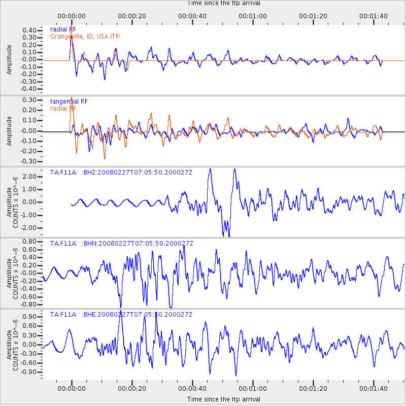
Earthquake location: Bonin Islands, Japan Region
Earthquake latitude/longitude: 26.8/142.4
Earthquake time(UTC): 2008/02/27 (058) 06:54:20 GMT
Earthquake Depth: 15 km
Earthquake Magnitude: 5.8 MB, 6.1 MS, 6.2 MW, 6.2 MW
Earthquake Catalog/Contributor: WHDF/NEIC
Network: TA USArray Transportable Network (new EarthScope stations)
Station: F11A Grangeville, ID, USA
Lat/Lon: 45.89 N/116.15 W
Elevation: 1186 m
Distance: 78.6 deg
Az: 44.303 deg
Baz: 296.664 deg
Ray Param: 0.049522385
Estimated Moho Depth: 61.25 km
Estimated Crust Vp/Vs: 1.91
Assumed Crust Vp: 6.571 km/s
Estimated Crust Vs: 3.431 km/s
Estimated Crust Poisson's Ratio: 0.31
Radial Match: 81.74623 %
Radial Bump: 400
Transverse Match: 61.510128 %
Transverse Bump: 400
SOD ConfigId: 2564
Insert Time: 2010-03-07 03:59:20.951 +0000
GWidth: 2.5
Max Bumps: 400
Tol: 0.001

Signal To Noise

ChannelStoNSTALTA
TA:F11A: :BHN:20080227T07:05:50.200027Z0.67540571.2758889E-71.8890704E-7
TA:F11A: :BHE:20080227T07:05:50.200027Z2.31383373.0991166E-71.339386E-7
TA:F11A: :BHZ:20080227T07:05:50.200027Z2.03395873.6238654E-71.7816811E-7
Arrivals
Ps8.8 SECOND
PpPs26 SECOND
PsPs/PpSs35 SECOND