
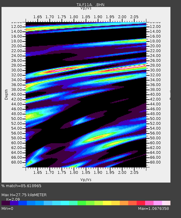
F11A Grangeville, ID, USA - Earthquake Result Viewer
| ||||||||||||||||||
| ||||||||||||||||||
| ||||||||||||||||||
|
Signal To Noise
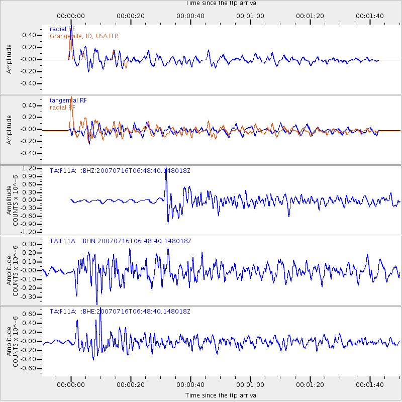
| Channel | StoN | STA | LTA |
| TA:F11A: :BHN:20070716T06:48:40.148018Z | 3.3348393 | 9.4609646E-8 | 2.8370078E-8 |
| TA:F11A: :BHE:20070716T06:48:40.148018Z | 3.7580004 | 1.6741575E-7 | 4.4549157E-8 |
| TA:F11A: :BHZ:20070716T06:48:40.148018Z | 11.232744 | 4.5151003E-7 | 4.019588E-8 |
| Arrivals | |
| Ps | 4.7 SECOND |
| PpPs | 13 SECOND |
| PsPs/PpSs | 17 SECOND |

