You are here: Home > Network List > TA - USArray Transportable Network (new EarthScope stations) Stations List
> Station R33M Jennings River, BC, CAN > Earthquake Result Viewer
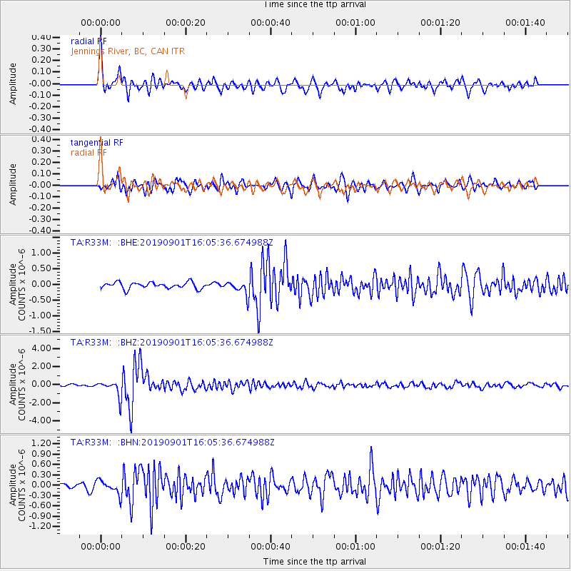
R33M Jennings River, BC, CAN - Earthquake Result Viewer
*The percent match for this event was below the threshold and hence no stack was calculated.
| Earthquake location: |
Fiji Islands Region |
| Earthquake latitude/longitude: |
-20.4/-178.4 |
| Earthquake time(UTC): |
2019/09/01 (244) 15:54:20 GMT |
| Earthquake Depth: |
617 km |
| Earthquake Magnitude: |
6.5 Mi |
| Earthquake Catalog/Contributor: |
NEIC PDE/at |
|
| Network: |
TA USArray Transportable Network (new EarthScope stations) |
| Station: |
R33M Jennings River, BC, CAN |
| Lat/Lon: |
59.39 N/130.97 W |
| Elevation: |
1437 m |
|
| Distance: |
88.5 deg |
| Az: |
22.146 deg |
| Baz: |
223.718 deg |
| Ray Param: |
$rayparam |
*The percent match for this event was below the threshold and hence was not used in the summary stack. |
|
| Radial Match: |
78.69633 % |
| Radial Bump: |
400 |
| Transverse Match: |
80.35172 % |
| Transverse Bump: |
400 |
| SOD ConfigId: |
19053131 |
| Insert Time: |
2019-09-15 16:04:22.201 +0000 |
| GWidth: |
2.5 |
| Max Bumps: |
400 |
| Tol: |
0.001 |
|
Signal To Noise
| Channel | StoN | STA | LTA |
| TA:R33M: :BHZ:20190901T16:05:36.674988Z | 10.012601 | 9.265583E-7 | 9.2539224E-8 |
| TA:R33M: :BHN:20190901T16:05:36.674988Z | 2.5723877 | 2.095256E-7 | 8.1451795E-8 |
| TA:R33M: :BHE:20190901T16:05:36.674988Z | 2.2658389 | 2.2676282E-7 | 1.0007897E-7 |
| Arrivals |
| Ps | |
| PpPs | |
| PsPs/PpSs | |


