You are here: Home > Network List > US - United States National Seismic Network Stations List
> Station MSO Missoula, Montana, USA > Earthquake Result Viewer
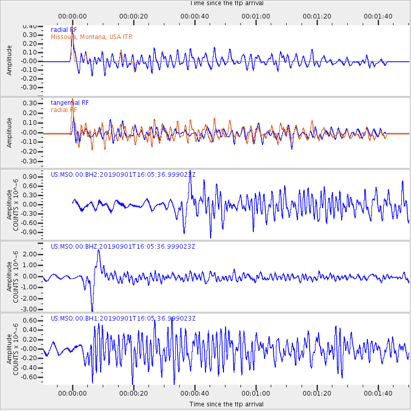
MSO Missoula, Montana, USA - Earthquake Result Viewer
*The percent match for this event was below the threshold and hence no stack was calculated.
| Earthquake location: |
Fiji Islands Region |
| Earthquake latitude/longitude: |
-20.4/-178.4 |
| Earthquake time(UTC): |
2019/09/01 (244) 15:54:20 GMT |
| Earthquake Depth: |
617 km |
| Earthquake Magnitude: |
6.5 Mi |
| Earthquake Catalog/Contributor: |
NEIC PDE/at |
|
| Network: |
US United States National Seismic Network |
| Station: |
MSO Missoula, Montana, USA |
| Lat/Lon: |
46.83 N/113.94 W |
| Elevation: |
1264 m |
|
| Distance: |
88.5 deg |
| Az: |
38.296 deg |
| Baz: |
237.85 deg |
| Ray Param: |
$rayparam |
*The percent match for this event was below the threshold and hence was not used in the summary stack. |
|
| Radial Match: |
77.221954 % |
| Radial Bump: |
400 |
| Transverse Match: |
73.830986 % |
| Transverse Bump: |
400 |
| SOD ConfigId: |
19053131 |
| Insert Time: |
2019-09-15 16:05:10.418 +0000 |
| GWidth: |
2.5 |
| Max Bumps: |
400 |
| Tol: |
0.001 |
|
Signal To Noise
| Channel | StoN | STA | LTA |
| US:MSO:00:BHZ:20190901T16:05:36.999023Z | 2.8434367 | 3.6018668E-7 | 1.26673E-7 |
| US:MSO:00:BH1:20190901T16:05:36.999023Z | 1.377334 | 1.2606041E-7 | 9.152494E-8 |
| US:MSO:00:BH2:20190901T16:05:36.999023Z | 1.9483277 | 1.8325468E-7 | 9.405743E-8 |
| Arrivals |
| Ps | |
| PpPs | |
| PsPs/PpSs | |


