You are here: Home > Network List > G - GEOSCOPE Stations List
> Station CLF Chambon la Foret observatory, France > Earthquake Result Viewer
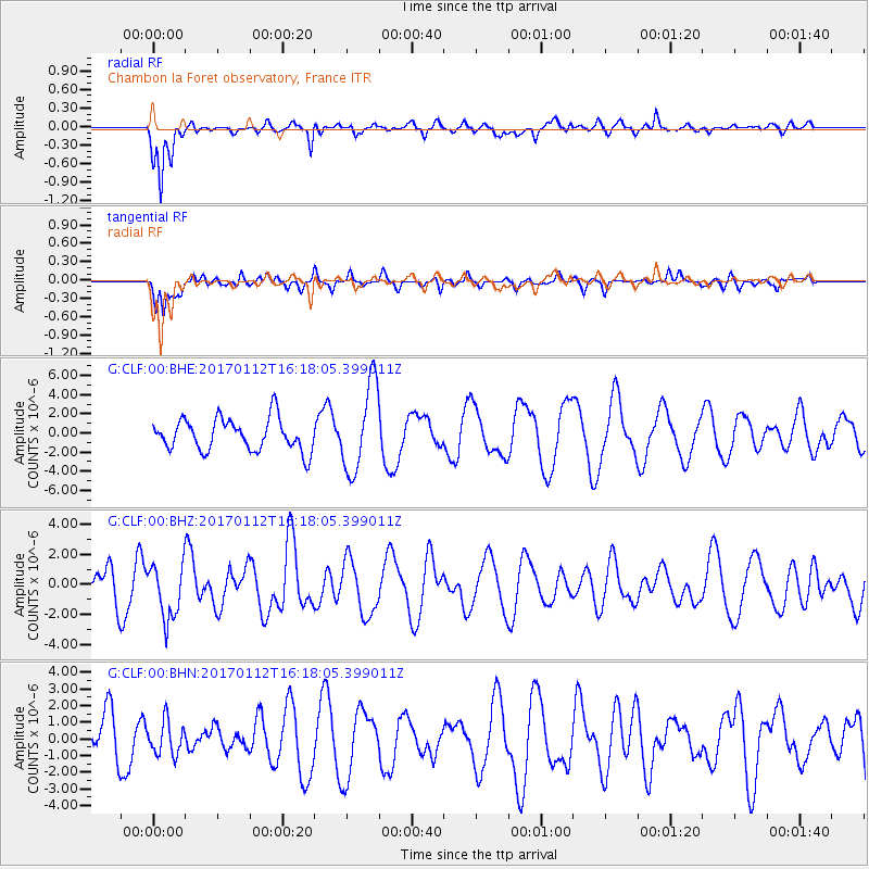
CLF Chambon la Foret observatory, France - Earthquake Result Viewer
*The percent match for this event was below the threshold and hence no stack was calculated.
| Earthquake location: |
Near West Coast Of Colombia |
| Earthquake latitude/longitude: |
6.1/-77.9 |
| Earthquake time(UTC): |
2017/01/12 (012) 16:06:31 GMT |
| Earthquake Depth: |
3.3 km |
| Earthquake Magnitude: |
5.5 mb |
| Earthquake Catalog/Contributor: |
NEIC PDE/us |
|
| Network: |
G GEOSCOPE |
| Station: |
CLF Chambon la Foret observatory, France |
| Lat/Lon: |
48.03 N/2.26 E |
| Elevation: |
145 m |
|
| Distance: |
79.0 deg |
| Az: |
42.37 deg |
| Baz: |
266.773 deg |
| Ray Param: |
$rayparam |
*The percent match for this event was below the threshold and hence was not used in the summary stack. |
|
| Radial Match: |
71.94207 % |
| Radial Bump: |
312 |
| Transverse Match: |
60.746925 % |
| Transverse Bump: |
400 |
| SOD ConfigId: |
1943534 |
| Insert Time: |
2017-01-26 16:07:13.744 +0000 |
| GWidth: |
2.5 |
| Max Bumps: |
400 |
| Tol: |
0.001 |
|
Signal To Noise
| Channel | StoN | STA | LTA |
| G:CLF:00:BHZ:20170112T16:18:05.399011Z | 1.2162535 | 1.8276093E-6 | 1.5026549E-6 |
| G:CLF:00:BHN:20170112T16:18:05.399011Z | 0.7160804 | 9.918515E-7 | 1.3851118E-6 |
| G:CLF:00:BHE:20170112T16:18:05.399011Z | 2.7328067 | 4.569005E-6 | 1.6719091E-6 |
| Arrivals |
| Ps | |
| PpPs | |
| PsPs/PpSs | |


