You are here: Home > Network List > GS - US Geological Survey Networks Stations List
> Station DEC08 Decatur Surface Seismic Site, Decatur, IL, USA > Earthquake Result Viewer
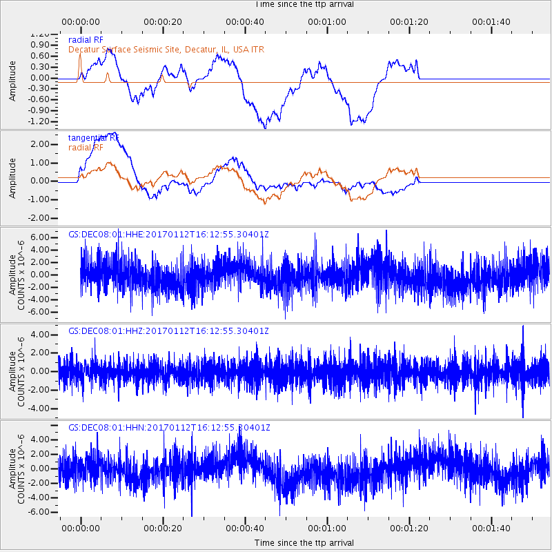
DEC08 Decatur Surface Seismic Site, Decatur, IL, USA - Earthquake Result Viewer
*The percent match for this event was below the threshold and hence no stack was calculated.
| Earthquake location: |
Near West Coast Of Colombia |
| Earthquake latitude/longitude: |
6.1/-77.9 |
| Earthquake time(UTC): |
2017/01/12 (012) 16:06:31 GMT |
| Earthquake Depth: |
3.3 km |
| Earthquake Magnitude: |
5.5 mb |
| Earthquake Catalog/Contributor: |
NEIC PDE/us |
|
| Network: |
GS US Geological Survey Networks |
| Station: |
DEC08 Decatur Surface Seismic Site, Decatur, IL, USA |
| Lat/Lon: |
39.86 N/88.92 W |
| Elevation: |
210 m |
|
| Distance: |
35.1 deg |
| Az: |
345.206 deg |
| Baz: |
160.736 deg |
| Ray Param: |
$rayparam |
*The percent match for this event was below the threshold and hence was not used in the summary stack. |
|
| Radial Match: |
47.048363 % |
| Radial Bump: |
400 |
| Transverse Match: |
46.725758 % |
| Transverse Bump: |
400 |
| SOD ConfigId: |
1943534 |
| Insert Time: |
2017-01-26 16:07:28.125 +0000 |
| GWidth: |
2.5 |
| Max Bumps: |
400 |
| Tol: |
0.001 |
|
Signal To Noise
| Channel | StoN | STA | LTA |
| GS:DEC08:01:HHZ:20170112T16:12:55.30401Z | 1.1220835 | 1.0370456E-6 | 9.2421425E-7 |
| GS:DEC08:01:HHN:20170112T16:12:55.30401Z | 0.94415385 | 1.5399542E-6 | 1.6310415E-6 |
| GS:DEC08:01:HHE:20170112T16:12:55.30401Z | 0.7979903 | 1.7534819E-6 | 2.1973724E-6 |
| Arrivals |
| Ps | |
| PpPs | |
| PsPs/PpSs | |


