You are here: Home > Network List > CN - Canadian National Seismograph Network Stations List
> Station INK INUVIK, NT > Earthquake Result Viewer
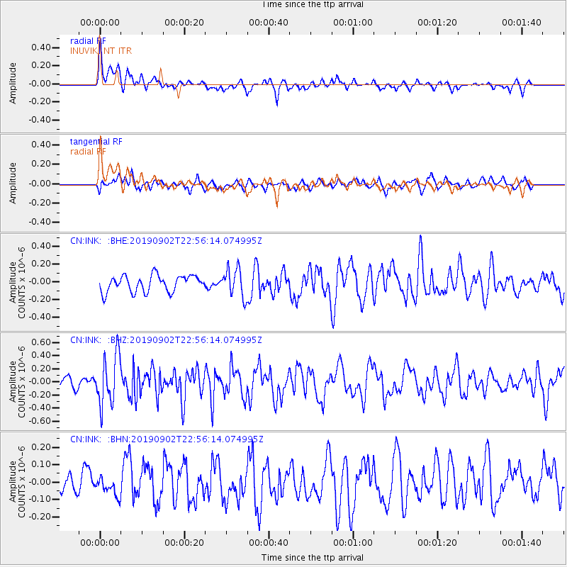
INK INUVIK, NT - Earthquake Result Viewer
*The percent match for this event was below the threshold and hence no stack was calculated.
| Earthquake location: |
Northern Mid-Atlantic Ridge |
| Earthquake latitude/longitude: |
23.8/-45.2 |
| Earthquake time(UTC): |
2019/09/02 (245) 22:45:48 GMT |
| Earthquake Depth: |
10 km |
| Earthquake Magnitude: |
5.9 Mww |
| Earthquake Catalog/Contributor: |
NEIC PDE/us |
|
| Network: |
CN Canadian National Seismograph Network |
| Station: |
INK INUVIK, NT |
| Lat/Lon: |
68.31 N/133.53 W |
| Elevation: |
44 m |
|
| Distance: |
67.6 deg |
| Az: |
336.291 deg |
| Baz: |
82.3 deg |
| Ray Param: |
$rayparam |
*The percent match for this event was below the threshold and hence was not used in the summary stack. |
|
| Radial Match: |
56.353905 % |
| Radial Bump: |
400 |
| Transverse Match: |
46.184563 % |
| Transverse Bump: |
400 |
| SOD ConfigId: |
19053131 |
| Insert Time: |
2019-09-16 22:52:30.749 +0000 |
| GWidth: |
2.5 |
| Max Bumps: |
400 |
| Tol: |
0.001 |
|
Signal To Noise
| Channel | StoN | STA | LTA |
| CN:INK: :BHZ:20190902T22:56:14.074995Z | 3.8333042 | 3.8752947E-7 | 1.0109542E-7 |
| CN:INK: :BHN:20190902T22:56:14.074995Z | 0.63163704 | 5.128752E-8 | 8.1197776E-8 |
| CN:INK: :BHE:20190902T22:56:14.074995Z | 1.8074417 | 1.6694156E-7 | 9.236346E-8 |
| Arrivals |
| Ps | |
| PpPs | |
| PsPs/PpSs | |


