You are here: Home > Network List > IU - Global Seismograph Network (GSN - IRIS/USGS) Stations List
> Station RSSD Black Hills, South Dakota, USA > Earthquake Result Viewer
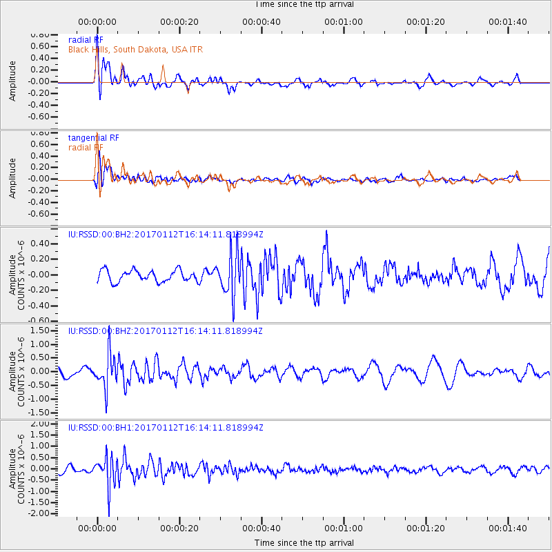
RSSD Black Hills, South Dakota, USA - Earthquake Result Viewer
*The percent match for this event was below the threshold and hence no stack was calculated.
| Earthquake location: |
Near West Coast Of Colombia |
| Earthquake latitude/longitude: |
6.1/-77.9 |
| Earthquake time(UTC): |
2017/01/12 (012) 16:06:31 GMT |
| Earthquake Depth: |
3.3 km |
| Earthquake Magnitude: |
5.5 mb |
| Earthquake Catalog/Contributor: |
NEIC PDE/us |
|
| Network: |
IU Global Seismograph Network (GSN - IRIS/USGS) |
| Station: |
RSSD Black Hills, South Dakota, USA |
| Lat/Lon: |
44.12 N/104.04 W |
| Elevation: |
2090 m |
|
| Distance: |
44.3 deg |
| Az: |
333.01 deg |
| Baz: |
141.195 deg |
| Ray Param: |
$rayparam |
*The percent match for this event was below the threshold and hence was not used in the summary stack. |
|
| Radial Match: |
63.668663 % |
| Radial Bump: |
400 |
| Transverse Match: |
54.888916 % |
| Transverse Bump: |
400 |
| SOD ConfigId: |
1943534 |
| Insert Time: |
2017-01-26 16:08:31.325 +0000 |
| GWidth: |
2.5 |
| Max Bumps: |
400 |
| Tol: |
0.001 |
|
Signal To Noise
| Channel | StoN | STA | LTA |
| IU:RSSD:00:BHZ:20170112T16:14:11.818994Z | 3.6915488 | 6.258251E-7 | 1.6952914E-7 |
| IU:RSSD:00:BH1:20170112T16:14:11.818994Z | 4.7439556 | 6.595261E-7 | 1.3902451E-7 |
| IU:RSSD:00:BH2:20170112T16:14:11.818994Z | 3.6744804 | 2.695403E-7 | 7.335467E-8 |
| Arrivals |
| Ps | |
| PpPs | |
| PsPs/PpSs | |


