You are here: Home > Network List > TA - USArray Transportable Network (new EarthScope stations) Stations List
> Station POKR Poker Plat Research Range, AK, USA > Earthquake Result Viewer
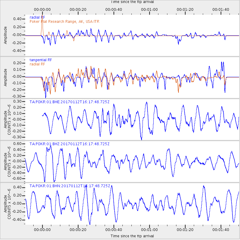
POKR Poker Plat Research Range, AK, USA - Earthquake Result Viewer
*The percent match for this event was below the threshold and hence no stack was calculated.
| Earthquake location: |
Near West Coast Of Colombia |
| Earthquake latitude/longitude: |
6.1/-77.9 |
| Earthquake time(UTC): |
2017/01/12 (012) 16:06:31 GMT |
| Earthquake Depth: |
3.3 km |
| Earthquake Magnitude: |
5.5 mb |
| Earthquake Catalog/Contributor: |
NEIC PDE/us |
|
| Network: |
TA USArray Transportable Network (new EarthScope stations) |
| Station: |
POKR Poker Plat Research Range, AK, USA |
| Lat/Lon: |
65.12 N/147.43 W |
| Elevation: |
501 m |
|
| Distance: |
76.0 deg |
| Az: |
335.891 deg |
| Baz: |
106.234 deg |
| Ray Param: |
$rayparam |
*The percent match for this event was below the threshold and hence was not used in the summary stack. |
|
| Radial Match: |
55.30808 % |
| Radial Bump: |
400 |
| Transverse Match: |
71.878494 % |
| Transverse Bump: |
400 |
| SOD ConfigId: |
1943534 |
| Insert Time: |
2017-01-26 16:09:40.815 +0000 |
| GWidth: |
2.5 |
| Max Bumps: |
400 |
| Tol: |
0.001 |
|
Signal To Noise
| Channel | StoN | STA | LTA |
| TA:POKR:01:BHZ:20170112T16:17:48.725Z | 2.7034304 | 4.100477E-7 | 1.5167682E-7 |
| TA:POKR:01:BHN:20170112T16:17:48.725Z | 0.7717189 | 1.4002488E-7 | 1.8144544E-7 |
| TA:POKR:01:BHE:20170112T16:17:48.725Z | 1.1306478 | 1.2880145E-7 | 1.13918276E-7 |
| Arrivals |
| Ps | |
| PpPs | |
| PsPs/PpSs | |


