You are here: Home > Network List > US - United States National Seismic Network Stations List
> Station EGMT Eagleton, Montana, USA > Earthquake Result Viewer
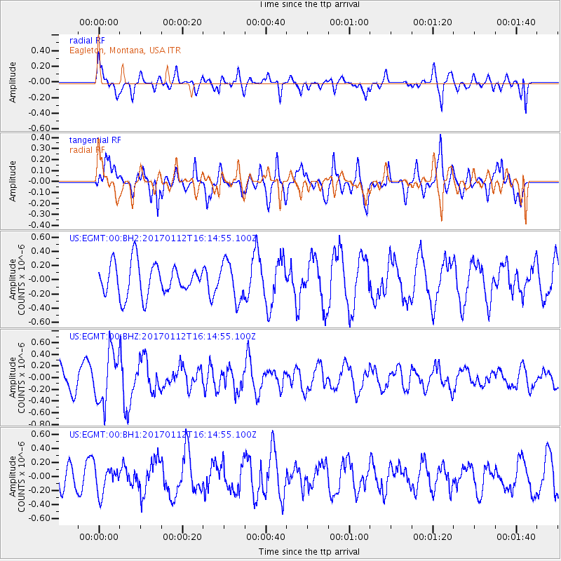
EGMT Eagleton, Montana, USA - Earthquake Result Viewer
*The percent match for this event was below the threshold and hence no stack was calculated.
| Earthquake location: |
Near West Coast Of Colombia |
| Earthquake latitude/longitude: |
6.1/-77.9 |
| Earthquake time(UTC): |
2017/01/12 (012) 16:06:31 GMT |
| Earthquake Depth: |
3.3 km |
| Earthquake Magnitude: |
5.5 mb |
| Earthquake Catalog/Contributor: |
NEIC PDE/us |
|
| Network: |
US United States National Seismic Network |
| Station: |
EGMT Eagleton, Montana, USA |
| Lat/Lon: |
48.02 N/109.75 W |
| Elevation: |
1055 m |
|
| Distance: |
49.8 deg |
| Az: |
332.41 deg |
| Baz: |
136.676 deg |
| Ray Param: |
$rayparam |
*The percent match for this event was below the threshold and hence was not used in the summary stack. |
|
| Radial Match: |
59.2621 % |
| Radial Bump: |
400 |
| Transverse Match: |
73.36521 % |
| Transverse Bump: |
400 |
| SOD ConfigId: |
1943534 |
| Insert Time: |
2017-01-26 16:10:00.815 +0000 |
| GWidth: |
2.5 |
| Max Bumps: |
400 |
| Tol: |
0.001 |
|
Signal To Noise
| Channel | StoN | STA | LTA |
| US:EGMT:00:BHZ:20170112T16:14:55.100Z | 2.6121416 | 4.5251736E-7 | 1.7323616E-7 |
| US:EGMT:00:BH1:20170112T16:14:55.100Z | 1.0399213 | 1.8300848E-7 | 1.7598302E-7 |
| US:EGMT:00:BH2:20170112T16:14:55.100Z | 1.2115766 | 2.709807E-7 | 2.2365958E-7 |
| Arrivals |
| Ps | |
| PpPs | |
| PsPs/PpSs | |


