You are here: Home > Network List > US - United States National Seismic Network Stations List
> Station MNTX Cornudas Mountains, Texas, USA > Earthquake Result Viewer
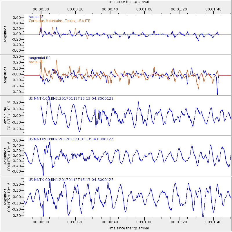
MNTX Cornudas Mountains, Texas, USA - Earthquake Result Viewer
*The percent match for this event was below the threshold and hence no stack was calculated.
| Earthquake location: |
Near West Coast Of Colombia |
| Earthquake latitude/longitude: |
6.1/-77.9 |
| Earthquake time(UTC): |
2017/01/12 (012) 16:06:31 GMT |
| Earthquake Depth: |
3.3 km |
| Earthquake Magnitude: |
5.5 mb |
| Earthquake Catalog/Contributor: |
NEIC PDE/us |
|
| Network: |
US United States National Seismic Network |
| Station: |
MNTX Cornudas Mountains, Texas, USA |
| Lat/Lon: |
31.70 N/105.38 W |
| Elevation: |
404 m |
|
| Distance: |
36.2 deg |
| Az: |
318.285 deg |
| Baz: |
129.072 deg |
| Ray Param: |
$rayparam |
*The percent match for this event was below the threshold and hence was not used in the summary stack. |
|
| Radial Match: |
63.89891 % |
| Radial Bump: |
400 |
| Transverse Match: |
58.631252 % |
| Transverse Bump: |
400 |
| SOD ConfigId: |
1943534 |
| Insert Time: |
2017-01-26 16:10:21.540 +0000 |
| GWidth: |
2.5 |
| Max Bumps: |
400 |
| Tol: |
0.001 |
|
Signal To Noise
| Channel | StoN | STA | LTA |
| US:MNTX:00:BHZ:20170112T16:13:04.800012Z | 2.7965078 | 3.4486007E-7 | 1.2331812E-7 |
| US:MNTX:00:BH1:20170112T16:13:04.800012Z | 1.200463 | 1.1660007E-7 | 9.712925E-8 |
| US:MNTX:00:BH2:20170112T16:13:04.800012Z | 0.60615677 | 7.701991E-8 | 1.2706269E-7 |
| Arrivals |
| Ps | |
| PpPs | |
| PsPs/PpSs | |


