You are here: Home > Network List > TA - USArray Transportable Network (new EarthScope stations) Stations List
> Station F26K Sheenjek River, AK, USA > Earthquake Result Viewer
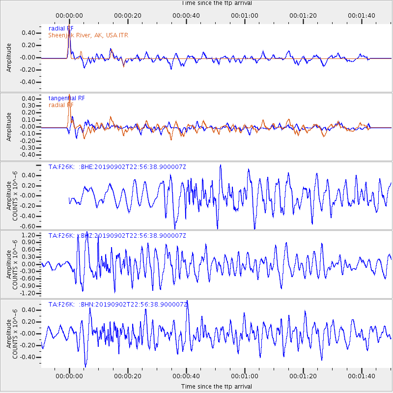
F26K Sheenjek River, AK, USA - Earthquake Result Viewer
*The percent match for this event was below the threshold and hence no stack was calculated.
| Earthquake location: |
Northern Mid-Atlantic Ridge |
| Earthquake latitude/longitude: |
23.8/-45.2 |
| Earthquake time(UTC): |
2019/09/02 (245) 22:45:48 GMT |
| Earthquake Depth: |
10 km |
| Earthquake Magnitude: |
5.9 Mww |
| Earthquake Catalog/Contributor: |
NEIC PDE/us |
|
| Network: |
TA USArray Transportable Network (new EarthScope stations) |
| Station: |
F26K Sheenjek River, AK, USA |
| Lat/Lon: |
67.69 N/144.15 W |
| Elevation: |
683 m |
|
| Distance: |
71.6 deg |
| Az: |
336.581 deg |
| Baz: |
72.56 deg |
| Ray Param: |
$rayparam |
*The percent match for this event was below the threshold and hence was not used in the summary stack. |
|
| Radial Match: |
68.811226 % |
| Radial Bump: |
383 |
| Transverse Match: |
69.34021 % |
| Transverse Bump: |
400 |
| SOD ConfigId: |
19053131 |
| Insert Time: |
2019-09-16 22:58:45.197 +0000 |
| GWidth: |
2.5 |
| Max Bumps: |
400 |
| Tol: |
0.001 |
|
Signal To Noise
| Channel | StoN | STA | LTA |
| TA:F26K: :BHZ:20190902T22:56:38.900007Z | 5.1444087 | 5.791416E-7 | 1.12576906E-7 |
| TA:F26K: :BHN:20190902T22:56:38.900007Z | 1.2244759 | 1.3000331E-7 | 1.0617058E-7 |
| TA:F26K: :BHE:20190902T22:56:38.900007Z | 1.5660573 | 2.3108348E-7 | 1.4755749E-7 |
| Arrivals |
| Ps | |
| PpPs | |
| PsPs/PpSs | |


