You are here: Home > Network List > US - United States National Seismic Network Stations List
> Station WRAK Wrangell Island, Southeastern Alaska, Alaska, USA > Earthquake Result Viewer
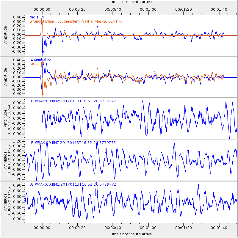
WRAK Wrangell Island, Southeastern Alaska, Alaska, USA - Earthquake Result Viewer
*The percent match for this event was below the threshold and hence no stack was calculated.
| Earthquake location: |
Northern Molucca Sea |
| Earthquake latitude/longitude: |
0.0/125.1 |
| Earthquake time(UTC): |
2017/01/13 (013) 16:39:25 GMT |
| Earthquake Depth: |
46 km |
| Earthquake Magnitude: |
5.7 mb |
| Earthquake Catalog/Contributor: |
NEIC PDE/us |
|
| Network: |
US United States National Seismic Network |
| Station: |
WRAK Wrangell Island, Southeastern Alaska, Alaska, USA |
| Lat/Lon: |
56.42 N/132.35 W |
| Elevation: |
81 m |
|
| Distance: |
96.9 deg |
| Az: |
33.115 deg |
| Baz: |
280.534 deg |
| Ray Param: |
$rayparam |
*The percent match for this event was below the threshold and hence was not used in the summary stack. |
|
| Radial Match: |
56.370132 % |
| Radial Bump: |
400 |
| Transverse Match: |
55.601032 % |
| Transverse Bump: |
400 |
| SOD ConfigId: |
1943534 |
| Insert Time: |
2017-01-27 16:42:48.751 +0000 |
| GWidth: |
2.5 |
| Max Bumps: |
400 |
| Tol: |
0.001 |
|
Signal To Noise
| Channel | StoN | STA | LTA |
| US:WRAK:00:BHZ:20170113T16:52:20.573977Z | 2.5743473 | 7.9975075E-7 | 3.1066156E-7 |
| US:WRAK:00:BH1:20170113T16:52:20.573977Z | 0.8262189 | 2.080242E-7 | 2.5177854E-7 |
| US:WRAK:00:BH2:20170113T16:52:20.573977Z | 1.551081 | 5.255589E-7 | 3.3883398E-7 |
| Arrivals |
| Ps | |
| PpPs | |
| PsPs/PpSs | |


