You are here: Home > Network List > PF - Volcanologic Network of Piton de Fournaise-OVPF Stations List
> Station GPS Grandes Pentes Sud > Earthquake Result Viewer
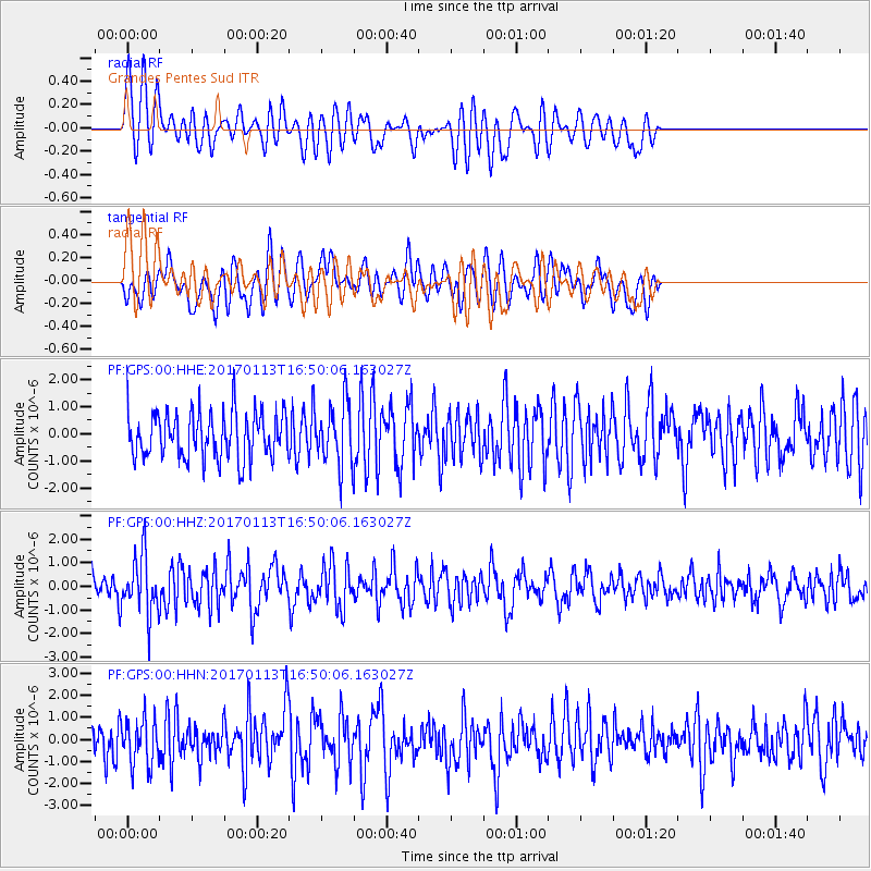
GPS Grandes Pentes Sud - Earthquake Result Viewer
*The percent match for this event was below the threshold and hence no stack was calculated.
| Earthquake location: |
Northern Molucca Sea |
| Earthquake latitude/longitude: |
0.0/125.1 |
| Earthquake time(UTC): |
2017/01/13 (013) 16:39:25 GMT |
| Earthquake Depth: |
46 km |
| Earthquake Magnitude: |
5.7 mb |
| Earthquake Catalog/Contributor: |
NEIC PDE/us |
|
| Network: |
PF Volcanologic Network of Piton de Fournaise-OVPF |
| Station: |
GPS Grandes Pentes Sud |
| Lat/Lon: |
21.27 S/55.76 E |
| Elevation: |
1004 m |
|
| Distance: |
70.8 deg |
| Az: |
247.535 deg |
| Baz: |
82.212 deg |
| Ray Param: |
$rayparam |
*The percent match for this event was below the threshold and hence was not used in the summary stack. |
|
| Radial Match: |
51.367313 % |
| Radial Bump: |
400 |
| Transverse Match: |
49.4282 % |
| Transverse Bump: |
400 |
| SOD ConfigId: |
1943534 |
| Insert Time: |
2017-01-27 16:43:00.052 +0000 |
| GWidth: |
2.5 |
| Max Bumps: |
400 |
| Tol: |
0.001 |
|
Signal To Noise
| Channel | StoN | STA | LTA |
| PF:GPS:00:HHZ:20170113T16:50:06.163027Z | 2.4213877 | 1.2383957E-6 | 5.1144053E-7 |
| PF:GPS:00:HHN:20170113T16:50:06.163027Z | 1.3263211 | 1.0548233E-6 | 7.953001E-7 |
| PF:GPS:00:HHE:20170113T16:50:06.163027Z | 1.3379579 | 1.1437837E-6 | 8.548727E-7 |
| Arrivals |
| Ps | |
| PpPs | |
| PsPs/PpSs | |


