You are here: Home > Network List > PF - Volcanologic Network of Piton de Fournaise-OVPF Stations List
> Station HIM cratere Himiltrude > Earthquake Result Viewer
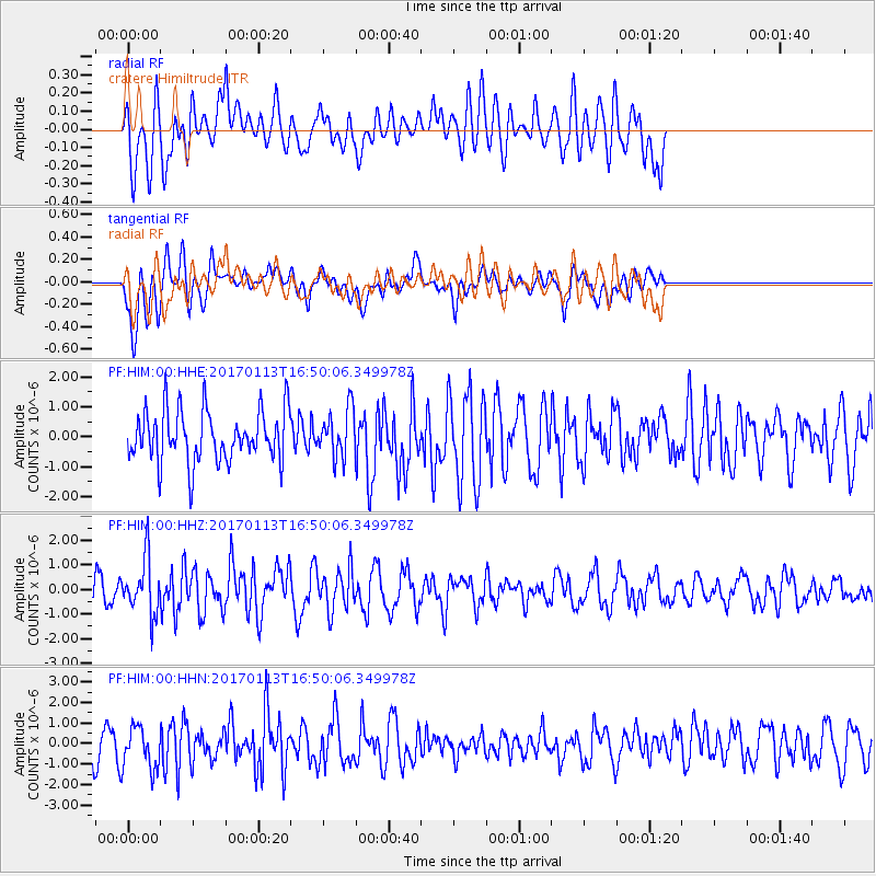
HIM cratere Himiltrude - Earthquake Result Viewer
*The percent match for this event was below the threshold and hence no stack was calculated.
| Earthquake location: |
Northern Molucca Sea |
| Earthquake latitude/longitude: |
0.0/125.1 |
| Earthquake time(UTC): |
2017/01/13 (013) 16:39:25 GMT |
| Earthquake Depth: |
46 km |
| Earthquake Magnitude: |
5.7 mb |
| Earthquake Catalog/Contributor: |
NEIC PDE/us |
|
| Network: |
PF Volcanologic Network of Piton de Fournaise-OVPF |
| Station: |
HIM cratere Himiltrude |
| Lat/Lon: |
21.21 S/55.72 E |
| Elevation: |
1958 m |
|
| Distance: |
70.8 deg |
| Az: |
247.599 deg |
| Baz: |
82.248 deg |
| Ray Param: |
$rayparam |
*The percent match for this event was below the threshold and hence was not used in the summary stack. |
|
| Radial Match: |
41.848976 % |
| Radial Bump: |
400 |
| Transverse Match: |
51.12838 % |
| Transverse Bump: |
400 |
| SOD ConfigId: |
1943534 |
| Insert Time: |
2017-01-27 16:43:03.327 +0000 |
| GWidth: |
2.5 |
| Max Bumps: |
400 |
| Tol: |
0.001 |
|
Signal To Noise
| Channel | StoN | STA | LTA |
| PF:HIM:00:HHZ:20170113T16:50:06.349978Z | 3.0322702 | 1.1336422E-6 | 3.738592E-7 |
| PF:HIM:00:HHN:20170113T16:50:06.349978Z | 1.6569328 | 1.0349763E-6 | 6.246338E-7 |
| PF:HIM:00:HHE:20170113T16:50:06.349978Z | 0.9309003 | 8.0103075E-7 | 8.604904E-7 |
| Arrivals |
| Ps | |
| PpPs | |
| PsPs/PpSs | |


