You are here: Home > Network List > TA - USArray Transportable Network (new EarthScope stations) Stations List
> Station E20K Nigu River, AK, USA > Earthquake Result Viewer
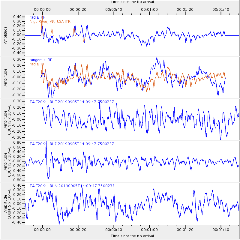
E20K Nigu River, AK, USA - Earthquake Result Viewer
*The percent match for this event was below the threshold and hence no stack was calculated.
| Earthquake location: |
South China Sea |
| Earthquake latitude/longitude: |
14.7/116.2 |
| Earthquake time(UTC): |
2019/09/05 (248) 13:58:34 GMT |
| Earthquake Depth: |
13 km |
| Earthquake Magnitude: |
5.3 Mww |
| Earthquake Catalog/Contributor: |
NEIC PDE/us |
|
| Network: |
TA USArray Transportable Network (new EarthScope stations) |
| Station: |
E20K Nigu River, AK, USA |
| Lat/Lon: |
68.26 N/156.19 W |
| Elevation: |
866 m |
|
| Distance: |
75.6 deg |
| Az: |
22.606 deg |
| Baz: |
273.388 deg |
| Ray Param: |
$rayparam |
*The percent match for this event was below the threshold and hence was not used in the summary stack. |
|
| Radial Match: |
47.376766 % |
| Radial Bump: |
400 |
| Transverse Match: |
36.90586 % |
| Transverse Bump: |
400 |
| SOD ConfigId: |
19053131 |
| Insert Time: |
2019-09-19 14:04:54.444 +0000 |
| GWidth: |
2.5 |
| Max Bumps: |
400 |
| Tol: |
0.001 |
|
Signal To Noise
| Channel | StoN | STA | LTA |
| TA:E20K: :BHZ:20190905T14:09:47.750023Z | 3.8065424 | 3.8299353E-7 | 1.0061455E-7 |
| TA:E20K: :BHN:20190905T14:09:47.750023Z | 1.7099704 | 2.4311913E-7 | 1.421774E-7 |
| TA:E20K: :BHE:20190905T14:09:47.750023Z | 1.0122181 | 1.0303967E-7 | 1.0179591E-7 |
| Arrivals |
| Ps | |
| PpPs | |
| PsPs/PpSs | |


