You are here: Home > Network List > US - United States National Seismic Network Stations List
> Station MNTX Cornudas Mountains, Texas, USA > Earthquake Result Viewer
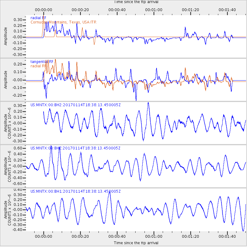
MNTX Cornudas Mountains, Texas, USA - Earthquake Result Viewer
*The percent match for this event was below the threshold and hence no stack was calculated.
| Earthquake location: |
Fiji Islands Region |
| Earthquake latitude/longitude: |
-18.7/176.1 |
| Earthquake time(UTC): |
2017/01/14 (014) 18:25:43 GMT |
| Earthquake Depth: |
4.6 km |
| Earthquake Magnitude: |
5.7 Mww |
| Earthquake Catalog/Contributor: |
NEIC PDE/us |
|
| Network: |
US United States National Seismic Network |
| Station: |
MNTX Cornudas Mountains, Texas, USA |
| Lat/Lon: |
31.70 N/105.38 W |
| Elevation: |
404 m |
|
| Distance: |
90.3 deg |
| Az: |
56.655 deg |
| Baz: |
248.309 deg |
| Ray Param: |
$rayparam |
*The percent match for this event was below the threshold and hence was not used in the summary stack. |
|
| Radial Match: |
40.132507 % |
| Radial Bump: |
400 |
| Transverse Match: |
60.878403 % |
| Transverse Bump: |
400 |
| SOD ConfigId: |
1943534 |
| Insert Time: |
2017-01-28 18:27:58.509 +0000 |
| GWidth: |
2.5 |
| Max Bumps: |
400 |
| Tol: |
0.001 |
|
Signal To Noise
| Channel | StoN | STA | LTA |
| US:MNTX:00:BHZ:20170114T18:38:13.450005Z | 2.2822063 | 3.17432E-7 | 1.3908998E-7 |
| US:MNTX:00:BH1:20170114T18:38:13.450005Z | 0.8531208 | 8.109312E-8 | 9.505467E-8 |
| US:MNTX:00:BH2:20170114T18:38:13.450005Z | 1.526859 | 1.5458211E-7 | 1.01241895E-7 |
| Arrivals |
| Ps | |
| PpPs | |
| PsPs/PpSs | |


