You are here: Home > Network List > US - United States National Seismic Network Stations List
> Station RLMT Red Lodge, Montana, USA > Earthquake Result Viewer
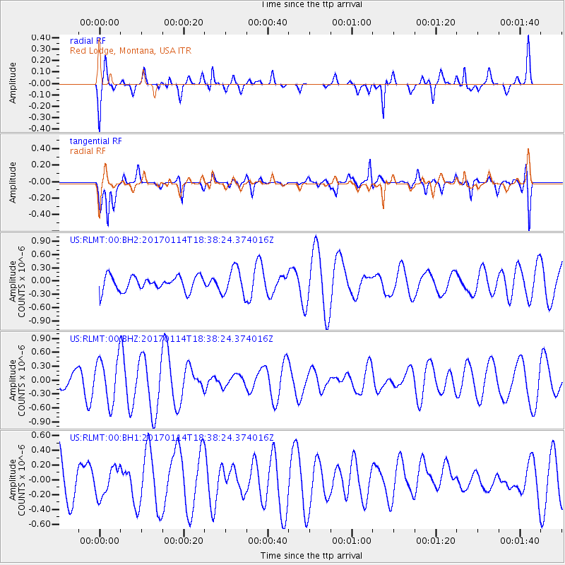
RLMT Red Lodge, Montana, USA - Earthquake Result Viewer
*The percent match for this event was below the threshold and hence no stack was calculated.
| Earthquake location: |
Fiji Islands Region |
| Earthquake latitude/longitude: |
-18.7/176.1 |
| Earthquake time(UTC): |
2017/01/14 (014) 18:25:43 GMT |
| Earthquake Depth: |
4.6 km |
| Earthquake Magnitude: |
5.7 Mww |
| Earthquake Catalog/Contributor: |
NEIC PDE/us |
|
| Network: |
US United States National Seismic Network |
| Station: |
RLMT Red Lodge, Montana, USA |
| Lat/Lon: |
45.12 N/109.27 W |
| Elevation: |
2086 m |
|
| Distance: |
92.7 deg |
| Az: |
43.113 deg |
| Baz: |
246.243 deg |
| Ray Param: |
$rayparam |
*The percent match for this event was below the threshold and hence was not used in the summary stack. |
|
| Radial Match: |
57.176765 % |
| Radial Bump: |
327 |
| Transverse Match: |
44.91905 % |
| Transverse Bump: |
378 |
| SOD ConfigId: |
1943534 |
| Insert Time: |
2017-01-28 18:28:02.667 +0000 |
| GWidth: |
2.5 |
| Max Bumps: |
400 |
| Tol: |
0.001 |
|
Signal To Noise
| Channel | StoN | STA | LTA |
| US:RLMT:00:BHZ:20170114T18:38:24.374016Z | 2.3463426 | 4.959716E-7 | 2.1138074E-7 |
| US:RLMT:00:BH1:20170114T18:38:24.374016Z | 0.68475074 | 1.9823221E-7 | 2.8949543E-7 |
| US:RLMT:00:BH2:20170114T18:38:24.374016Z | 1.8912673 | 3.0820854E-7 | 1.6296403E-7 |
| Arrivals |
| Ps | |
| PpPs | |
| PsPs/PpSs | |


