You are here: Home > Network List > CN - Canadian National Seismograph Network Stations List
> Station INK INUVIK, NT > Earthquake Result Viewer
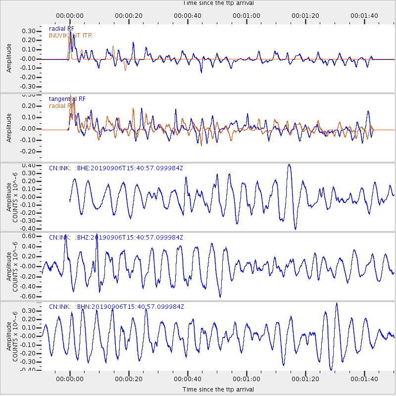
INK INUVIK, NT - Earthquake Result Viewer
*The percent match for this event was below the threshold and hence no stack was calculated.
| Earthquake location: |
Loyalty Islands |
| Earthquake latitude/longitude: |
-20.2/169.0 |
| Earthquake time(UTC): |
2019/09/06 (249) 15:27:57 GMT |
| Earthquake Depth: |
26 km |
| Earthquake Magnitude: |
5.8 Mww |
| Earthquake Catalog/Contributor: |
NEIC PDE/us |
|
| Network: |
CN Canadian National Seismograph Network |
| Station: |
INK INUVIK, NT |
| Lat/Lon: |
68.31 N/133.53 W |
| Elevation: |
44 m |
|
| Distance: |
97.5 deg |
| Az: |
18.433 deg |
| Baz: |
233.03 deg |
| Ray Param: |
$rayparam |
*The percent match for this event was below the threshold and hence was not used in the summary stack. |
|
| Radial Match: |
59.508427 % |
| Radial Bump: |
400 |
| Transverse Match: |
58.376358 % |
| Transverse Bump: |
400 |
| SOD ConfigId: |
19053131 |
| Insert Time: |
2019-09-20 15:32:38.962 +0000 |
| GWidth: |
2.5 |
| Max Bumps: |
400 |
| Tol: |
0.001 |
|
Signal To Noise
| Channel | StoN | STA | LTA |
| CN:INK: :BHZ:20190906T15:40:57.099984Z | 1.9547584 | 2.5745092E-7 | 1.3170472E-7 |
| CN:INK: :BHN:20190906T15:40:57.099984Z | 1.8855714 | 2.0980936E-7 | 1.11270964E-7 |
| CN:INK: :BHE:20190906T15:40:57.099984Z | 0.64920527 | 8.821241E-8 | 1.3587753E-7 |
| Arrivals |
| Ps | |
| PpPs | |
| PsPs/PpSs | |


