You are here: Home > Network List > TA - USArray Transportable Network (new EarthScope stations) Stations List
> Station I04A Tendick Farm, Oakridge, OR, USA > Earthquake Result Viewer
I04A Tendick Farm, Oakridge, OR, USA - Earthquake Result Viewer

| Earthquake location: |
South Of Mariana Islands |
| Earthquake latitude/longitude: |
10.5/145.7 |
| Earthquake time(UTC): |
2007/09/30 (273) 02:08:30 GMT |
| Earthquake Depth: |
14 km |
| Earthquake Magnitude: |
6.4 MB, 7.1 MS, 6.9 MW, 6.9 MW |
| Earthquake Catalog/Contributor: |
WHDF/NEIC |
|
| Network: |
TA USArray Transportable Network (new EarthScope stations) |
| Station: |
I04A Tendick Farm, Oakridge, OR, USA |
| Lat/Lon: |
43.79 N/122.41 W |
| Elevation: |
731 m |
|
| Distance: |
84.2 deg |
| Az: |
46.676 deg |
| Baz: |
278.828 deg |
| Ray Param: |
0.045644693 |
| Estimated Moho Depth: |
29.0 km |
| Estimated Crust Vp/Vs: |
1.92 |
| Assumed Crust Vp: |
6.522 km/s |
| Estimated Crust Vs: |
3.401 km/s |
| Estimated Crust Poisson's Ratio: |
0.31 |
|
| Radial Match: |
94.266045 % |
| Radial Bump: |
400 |
| Transverse Match: |
87.281944 % |
| Transverse Bump: |
400 |
| SOD ConfigId: |
2564 |
| Insert Time: |
2010-03-07 04:11:23.370 +0000 |
| GWidth: |
2.5 |
| Max Bumps: |
400 |
| Tol: |
0.001 |
|
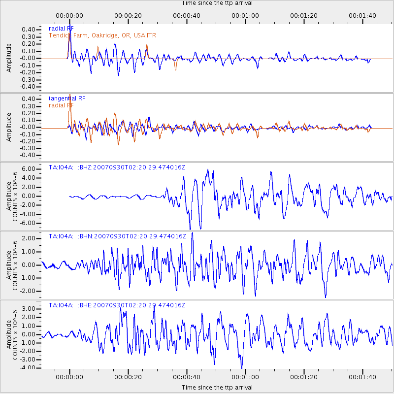
Signal To Noise
| Channel | StoN | STA | LTA |
| TA:I04A: :BHN:20070930T02:20:29.474016Z | 1.3213055 | 2.0830039E-7 | 1.576474E-7 |
| TA:I04A: :BHE:20070930T02:20:29.474016Z | 1.9630747 | 3.121043E-7 | 1.5898749E-7 |
| TA:I04A: :BHZ:20070930T02:20:29.474016Z | 2.5397272 | 6.2477477E-7 | 2.4600072E-7 |
| Arrivals |
| Ps | 4.2 SECOND |
| PpPs | 13 SECOND |
| PsPs/PpSs | 17 SECOND |


