You are here: Home > Network List > TS - TERRAscope (Southern California Seismic Network) Stations List
> Station MLAC Mammoth Lakes, California, USA > Earthquake Result Viewer
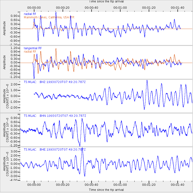
MLAC Mammoth Lakes, California, USA - Earthquake Result Viewer
*The percent match for this event was below the threshold and hence no stack was calculated.
| Earthquake location: |
Samoa Islands Region |
| Earthquake latitude/longitude: |
-16.7/-172.8 |
| Earthquake time(UTC): |
1993/07/20 (201) 07:38:18 GMT |
| Earthquake Depth: |
32 km |
| Earthquake Magnitude: |
5.2 MB, 5.8 MS |
| Earthquake Catalog/Contributor: |
WHDF/NEIC |
|
| Network: |
TS TERRAscope (Southern California Seismic Network) |
| Station: |
MLAC Mammoth Lakes, California, USA |
| Lat/Lon: |
37.63 N/118.83 W |
| Elevation: |
2170 m |
|
| Distance: |
74.1 deg |
| Az: |
41.895 deg |
| Baz: |
233.721 deg |
| Ray Param: |
$rayparam |
*The percent match for this event was below the threshold and hence was not used in the summary stack. |
|
| Radial Match: |
83.13737 % |
| Radial Bump: |
400 |
| Transverse Match: |
77.996346 % |
| Transverse Bump: |
400 |
| SOD ConfigId: |
4480 |
| Insert Time: |
2010-02-26 14:28:25.321 +0000 |
| GWidth: |
2.5 |
| Max Bumps: |
400 |
| Tol: |
0.001 |
|
Signal To Noise
| Channel | StoN | STA | LTA |
| TS:MLAC: :BHN:19930720T07:49:20.787Z | 1.2894388 | 1.2693765E-7 | 9.8444104E-8 |
| TS:MLAC: :BHE:19930720T07:49:20.787Z | 1.1972728 | 6.60451E-7 | 5.516295E-7 |
| TS:MLAC: :BHZ:19930720T07:49:20.787Z | 0.99251825 | 2.575371E-7 | 2.5947844E-7 |
| Arrivals |
| Ps | |
| PpPs | |
| PsPs/PpSs | |


