You are here: Home > Network List > G - GEOSCOPE Stations List
> Station ATD Arta Cave - Arta, Republic of Djibouti > Earthquake Result Viewer
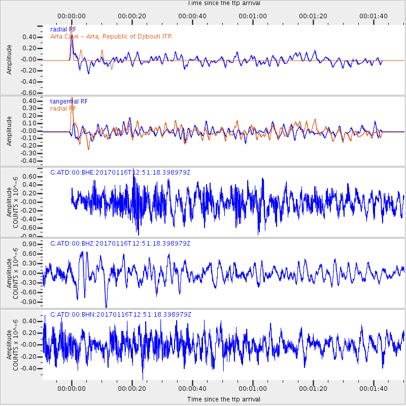
ATD Arta Cave - Arta, Republic of Djibouti - Earthquake Result Viewer
*The percent match for this event was below the threshold and hence no stack was calculated.
| Earthquake location: |
Northern Sumatra, Indonesia |
| Earthquake latitude/longitude: |
3.3/98.5 |
| Earthquake time(UTC): |
2017/01/16 (016) 12:42:12 GMT |
| Earthquake Depth: |
10 km |
| Earthquake Magnitude: |
5.7 mb |
| Earthquake Catalog/Contributor: |
NEIC PDE/us |
|
| Network: |
G GEOSCOPE |
| Station: |
ATD Arta Cave - Arta, Republic of Djibouti |
| Lat/Lon: |
11.53 N/42.85 E |
| Elevation: |
610 m |
|
| Distance: |
55.8 deg |
| Az: |
281.665 deg |
| Baz: |
93.917 deg |
| Ray Param: |
$rayparam |
*The percent match for this event was below the threshold and hence was not used in the summary stack. |
|
| Radial Match: |
65.576775 % |
| Radial Bump: |
400 |
| Transverse Match: |
60.02349 % |
| Transverse Bump: |
400 |
| SOD ConfigId: |
1943534 |
| Insert Time: |
2017-01-30 12:42:38.141 +0000 |
| GWidth: |
2.5 |
| Max Bumps: |
400 |
| Tol: |
0.001 |
|
Signal To Noise
| Channel | StoN | STA | LTA |
| G:ATD:00:BHZ:20170116T12:51:18.398979Z | 3.5393906 | 4.2482796E-7 | 1.2002856E-7 |
| G:ATD:00:BHN:20170116T12:51:18.398979Z | 0.9474516 | 1.5544752E-7 | 1.6406909E-7 |
| G:ATD:00:BHE:20170116T12:51:18.398979Z | 1.3010305 | 2.827903E-7 | 2.173587E-7 |
| Arrivals |
| Ps | |
| PpPs | |
| PsPs/PpSs | |


