You are here: Home > Network List > US - United States National Seismic Network Stations List
> Station MSO Missoula, Montana, USA > Earthquake Result Viewer
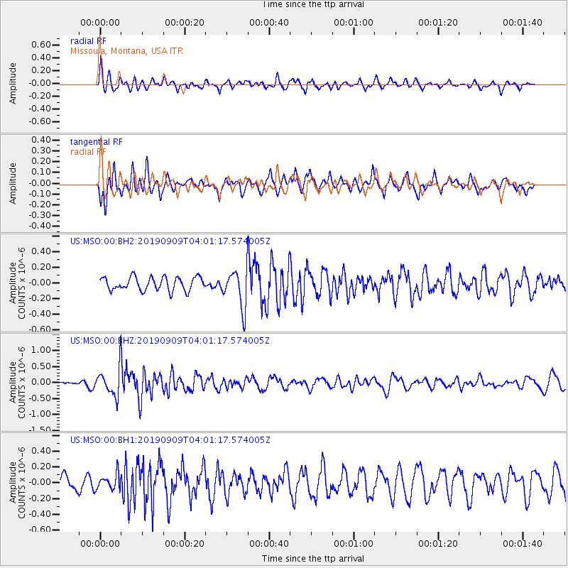
MSO Missoula, Montana, USA - Earthquake Result Viewer
*The percent match for this event was below the threshold and hence no stack was calculated.
| Earthquake location: |
Andreanof Islands, Aleutian Is. |
| Earthquake latitude/longitude: |
50.9/-179.3 |
| Earthquake time(UTC): |
2019/09/09 (252) 03:54:01 GMT |
| Earthquake Depth: |
38 km |
| Earthquake Magnitude: |
5.5 Mi |
| Earthquake Catalog/Contributor: |
NEIC PDE/at |
|
| Network: |
US United States National Seismic Network |
| Station: |
MSO Missoula, Montana, USA |
| Lat/Lon: |
46.83 N/113.94 W |
| Elevation: |
1264 m |
|
| Distance: |
41.9 deg |
| Az: |
69.032 deg |
| Baz: |
300.483 deg |
| Ray Param: |
$rayparam |
*The percent match for this event was below the threshold and hence was not used in the summary stack. |
|
| Radial Match: |
54.091854 % |
| Radial Bump: |
400 |
| Transverse Match: |
69.8483 % |
| Transverse Bump: |
400 |
| SOD ConfigId: |
19053131 |
| Insert Time: |
2019-09-23 04:02:56.517 +0000 |
| GWidth: |
2.5 |
| Max Bumps: |
400 |
| Tol: |
0.001 |
|
Signal To Noise
| Channel | StoN | STA | LTA |
| US:MSO:00:BHZ:20190909T04:01:17.574005Z | 3.6530907 | 4.2861174E-7 | 1.17328526E-7 |
| US:MSO:00:BH1:20190909T04:01:17.574005Z | 0.79691917 | 9.4141306E-8 | 1.1813156E-7 |
| US:MSO:00:BH2:20190909T04:01:17.574005Z | 2.8693566 | 2.4562152E-7 | 8.56016E-8 |
| Arrivals |
| Ps | |
| PpPs | |
| PsPs/PpSs | |


