You are here: Home > Network List > II - Global Seismograph Network (GSN - IRIS/IDA) Stations List
> Station WRAB Tennant Creek, NT, Australia > Earthquake Result Viewer
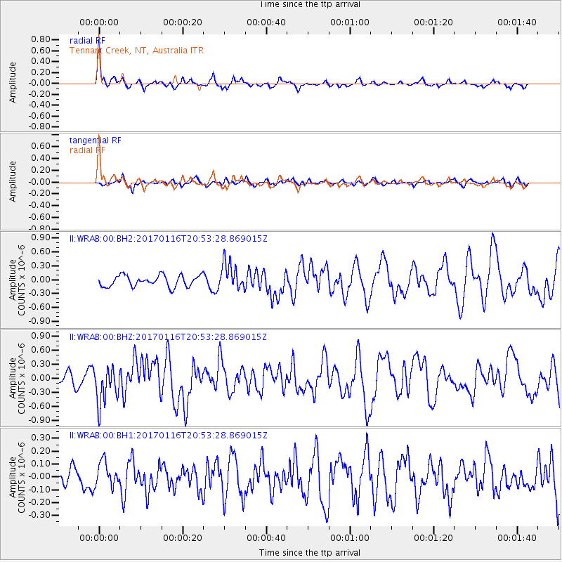
WRAB Tennant Creek, NT, Australia - Earthquake Result Viewer
*The percent match for this event was below the threshold and hence no stack was calculated.
| Earthquake location: |
Vanuatu Islands |
| Earthquake latitude/longitude: |
-13.5/166.5 |
| Earthquake time(UTC): |
2017/01/16 (016) 20:47:38 GMT |
| Earthquake Depth: |
10 km |
| Earthquake Magnitude: |
5.7 Mwb |
| Earthquake Catalog/Contributor: |
NEIC PDE/us |
|
| Network: |
II Global Seismograph Network (GSN - IRIS/IDA) |
| Station: |
WRAB Tennant Creek, NT, Australia |
| Lat/Lon: |
19.93 S/134.36 E |
| Elevation: |
366 m |
|
| Distance: |
31.4 deg |
| Az: |
253.81 deg |
| Baz: |
83.224 deg |
| Ray Param: |
$rayparam |
*The percent match for this event was below the threshold and hence was not used in the summary stack. |
|
| Radial Match: |
65.694145 % |
| Radial Bump: |
252 |
| Transverse Match: |
61.556316 % |
| Transverse Bump: |
400 |
| SOD ConfigId: |
1943534 |
| Insert Time: |
2017-01-30 20:55:04.783 +0000 |
| GWidth: |
2.5 |
| Max Bumps: |
400 |
| Tol: |
0.001 |
|
Signal To Noise
| Channel | StoN | STA | LTA |
| II:WRAB:00:BHZ:20170116T20:53:28.869015Z | 2.5476453 | 4.0530998E-7 | 1.5909198E-7 |
| II:WRAB:00:BH1:20170116T20:53:28.869015Z | 0.9471342 | 9.639378E-8 | 1.0177415E-7 |
| II:WRAB:00:BH2:20170116T20:53:28.869015Z | 2.4656496 | 2.964108E-7 | 1.202161E-7 |
| Arrivals |
| Ps | |
| PpPs | |
| PsPs/PpSs | |


