You are here: Home > Network List > US - United States National Seismic Network Stations List
> Station AMTX Amarillo, Texas, USA > Earthquake Result Viewer
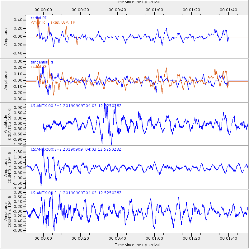
AMTX Amarillo, Texas, USA - Earthquake Result Viewer
*The percent match for this event was below the threshold and hence no stack was calculated.
| Earthquake location: |
Andreanof Islands, Aleutian Is. |
| Earthquake latitude/longitude: |
51.5/-178.6 |
| Earthquake time(UTC): |
2019/09/09 (252) 03:54:08 GMT |
| Earthquake Depth: |
35 km |
| Earthquake Magnitude: |
5.3 Mww |
| Earthquake Catalog/Contributor: |
NEIC PDE/us |
|
| Network: |
US United States National Seismic Network |
| Station: |
AMTX Amarillo, Texas, USA |
| Lat/Lon: |
34.53 N/101.41 W |
| Elevation: |
1010 m |
|
| Distance: |
56.3 deg |
| Az: |
75.393 deg |
| Baz: |
312.949 deg |
| Ray Param: |
$rayparam |
*The percent match for this event was below the threshold and hence was not used in the summary stack. |
|
| Radial Match: |
44.57746 % |
| Radial Bump: |
400 |
| Transverse Match: |
60.9246 % |
| Transverse Bump: |
400 |
| SOD ConfigId: |
19053131 |
| Insert Time: |
2019-09-23 04:11:59.559 +0000 |
| GWidth: |
2.5 |
| Max Bumps: |
400 |
| Tol: |
0.001 |
|
Signal To Noise
| Channel | StoN | STA | LTA |
| US:AMTX:00:BHZ:20190909T04:03:12.525028Z | 3.5936043 | 9.1716345E-7 | 2.5522104E-7 |
| US:AMTX:00:BH1:20190909T04:03:12.525028Z | 3.4386332 | 4.5077473E-7 | 1.3109124E-7 |
| US:AMTX:00:BH2:20190909T04:03:12.525028Z | 3.4945126 | 6.4994975E-7 | 1.8599154E-7 |
| Arrivals |
| Ps | |
| PpPs | |
| PsPs/PpSs | |


