You are here: Home > Network List > PF - Volcanologic Network of Piton de Fournaise-OVPF Stations List
> Station HIM cratere Himiltrude > Earthquake Result Viewer
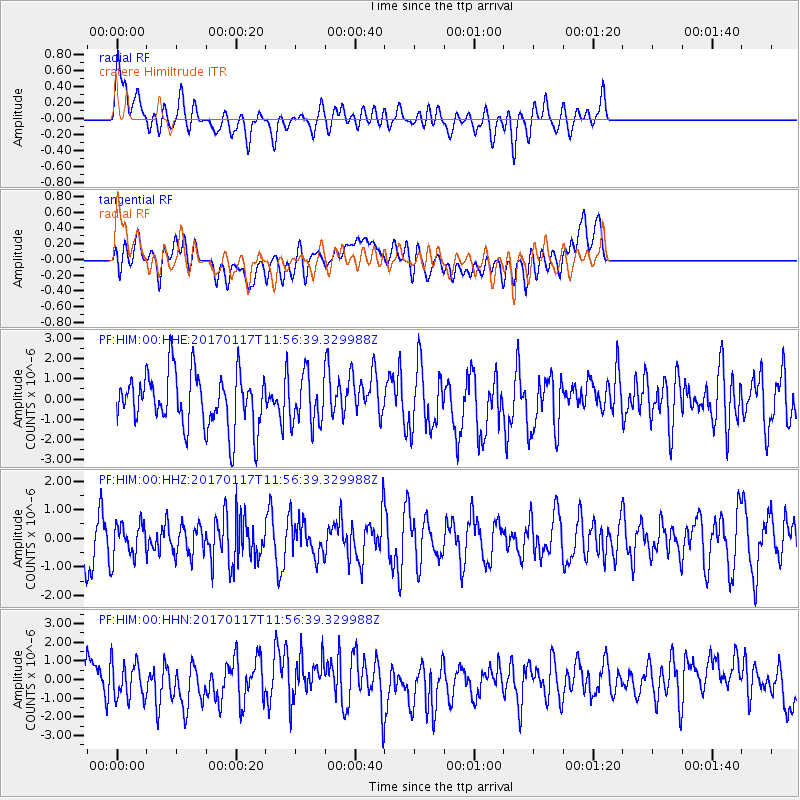
HIM cratere Himiltrude - Earthquake Result Viewer
*The percent match for this event was below the threshold and hence no stack was calculated.
| Earthquake location: |
Northern Sumatra, Indonesia |
| Earthquake latitude/longitude: |
5.4/94.6 |
| Earthquake time(UTC): |
2017/01/17 (017) 11:48:48 GMT |
| Earthquake Depth: |
55 km |
| Earthquake Magnitude: |
5.6 mb |
| Earthquake Catalog/Contributor: |
NEIC PDE/us |
|
| Network: |
PF Volcanologic Network of Piton de Fournaise-OVPF |
| Station: |
HIM cratere Himiltrude |
| Lat/Lon: |
21.21 S/55.72 E |
| Elevation: |
1958 m |
|
| Distance: |
46.4 deg |
| Az: |
233.948 deg |
| Baz: |
59.614 deg |
| Ray Param: |
$rayparam |
*The percent match for this event was below the threshold and hence was not used in the summary stack. |
|
| Radial Match: |
50.80336 % |
| Radial Bump: |
400 |
| Transverse Match: |
36.96622 % |
| Transverse Bump: |
400 |
| SOD ConfigId: |
1943534 |
| Insert Time: |
2017-01-31 11:55:19.966 +0000 |
| GWidth: |
2.5 |
| Max Bumps: |
400 |
| Tol: |
0.001 |
|
Signal To Noise
| Channel | StoN | STA | LTA |
| PF:HIM:00:HHZ:20170117T11:56:39.329988Z | 0.65704936 | 6.03079E-7 | 9.1785955E-7 |
| PF:HIM:00:HHN:20170117T11:56:39.329988Z | 0.9107897 | 9.524815E-7 | 1.0457754E-6 |
| PF:HIM:00:HHE:20170117T11:56:39.329988Z | 0.886148 | 1.1893871E-6 | 1.3421993E-6 |
| Arrivals |
| Ps | |
| PpPs | |
| PsPs/PpSs | |


