You are here: Home > Network List > TA - USArray Transportable Network (new EarthScope stations) Stations List
> Station G21K Allakaket, AK, USA > Earthquake Result Viewer
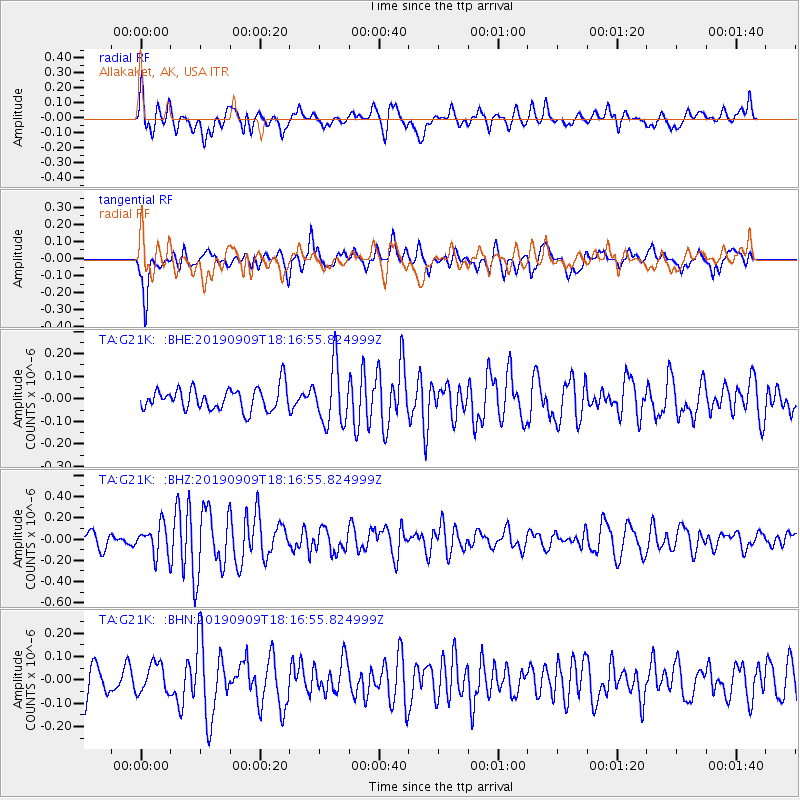
G21K Allakaket, AK, USA - Earthquake Result Viewer
*The percent match for this event was below the threshold and hence no stack was calculated.
| Earthquake location: |
Near Coast Of Venezuela |
| Earthquake latitude/longitude: |
10.5/-64.4 |
| Earthquake time(UTC): |
2019/09/09 (252) 18:05:17 GMT |
| Earthquake Depth: |
10 km |
| Earthquake Magnitude: |
5.5 Mww |
| Earthquake Catalog/Contributor: |
NEIC PDE/us |
|
| Network: |
TA USArray Transportable Network (new EarthScope stations) |
| Station: |
G21K Allakaket, AK, USA |
| Lat/Lon: |
66.52 N/153.51 W |
| Elevation: |
446 m |
|
| Distance: |
80.1 deg |
| Az: |
335.999 deg |
| Baz: |
86.642 deg |
| Ray Param: |
$rayparam |
*The percent match for this event was below the threshold and hence was not used in the summary stack. |
|
| Radial Match: |
63.229645 % |
| Radial Bump: |
400 |
| Transverse Match: |
58.834007 % |
| Transverse Bump: |
400 |
| SOD ConfigId: |
19053131 |
| Insert Time: |
2019-09-23 18:14:53.311 +0000 |
| GWidth: |
2.5 |
| Max Bumps: |
400 |
| Tol: |
0.001 |
|
Signal To Noise
| Channel | StoN | STA | LTA |
| TA:G21K: :BHZ:20190909T18:16:55.824999Z | 2.1880414 | 1.421139E-7 | 6.495028E-8 |
| TA:G21K: :BHN:20190909T18:16:55.824999Z | 1.0206645 | 6.3559135E-8 | 6.227231E-8 |
| TA:G21K: :BHE:20190909T18:16:55.824999Z | 2.5893033 | 1.2876369E-7 | 4.972909E-8 |
| Arrivals |
| Ps | |
| PpPs | |
| PsPs/PpSs | |


