You are here: Home > Network List > TA - USArray Transportable Network (new EarthScope stations) Stations List
> Station R33M Jennings River, BC, CAN > Earthquake Result Viewer
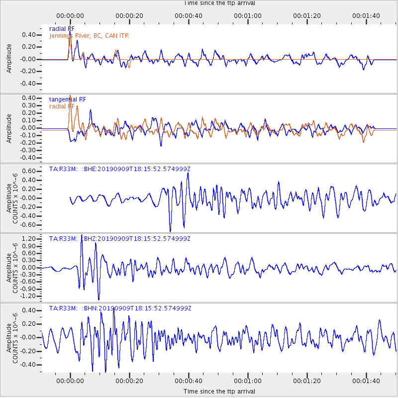
R33M Jennings River, BC, CAN - Earthquake Result Viewer
*The percent match for this event was below the threshold and hence no stack was calculated.
| Earthquake location: |
Near Coast Of Venezuela |
| Earthquake latitude/longitude: |
10.5/-64.4 |
| Earthquake time(UTC): |
2019/09/09 (252) 18:05:17 GMT |
| Earthquake Depth: |
10 km |
| Earthquake Magnitude: |
5.5 Mww |
| Earthquake Catalog/Contributor: |
NEIC PDE/us |
|
| Network: |
TA USArray Transportable Network (new EarthScope stations) |
| Station: |
R33M Jennings River, BC, CAN |
| Lat/Lon: |
59.39 N/130.97 W |
| Elevation: |
1437 m |
|
| Distance: |
69.2 deg |
| Az: |
329.858 deg |
| Baz: |
105.144 deg |
| Ray Param: |
$rayparam |
*The percent match for this event was below the threshold and hence was not used in the summary stack. |
|
| Radial Match: |
67.3181 % |
| Radial Bump: |
400 |
| Transverse Match: |
73.373055 % |
| Transverse Bump: |
400 |
| SOD ConfigId: |
19053131 |
| Insert Time: |
2019-09-23 18:15:35.492 +0000 |
| GWidth: |
2.5 |
| Max Bumps: |
400 |
| Tol: |
0.001 |
|
Signal To Noise
| Channel | StoN | STA | LTA |
| TA:R33M: :BHZ:20190909T18:15:52.574999Z | 5.660118 | 4.979776E-7 | 8.7980084E-8 |
| TA:R33M: :BHN:20190909T18:15:52.574999Z | 1.7894957 | 1.6214022E-7 | 9.060666E-8 |
| TA:R33M: :BHE:20190909T18:15:52.574999Z | 4.3886085 | 2.72202E-7 | 6.202467E-8 |
| Arrivals |
| Ps | |
| PpPs | |
| PsPs/PpSs | |


