You are here: Home > Network List > US - United States National Seismic Network Stations List
> Station CBKS Cedar Bluff, Kansas, USA > Earthquake Result Viewer
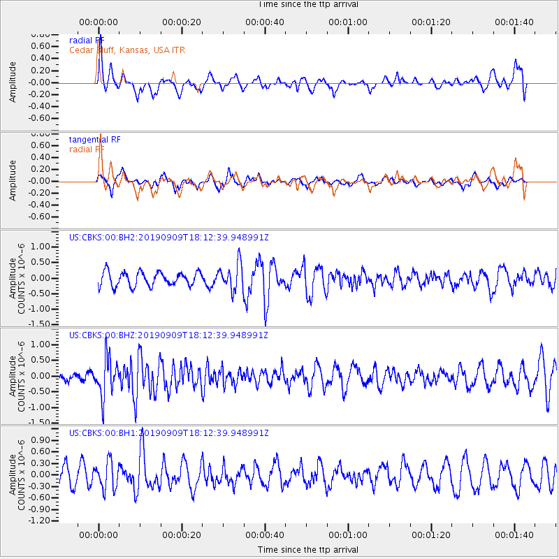
CBKS Cedar Bluff, Kansas, USA - Earthquake Result Viewer
*The percent match for this event was below the threshold and hence no stack was calculated.
| Earthquake location: |
Near Coast Of Venezuela |
| Earthquake latitude/longitude: |
10.5/-64.4 |
| Earthquake time(UTC): |
2019/09/09 (252) 18:05:17 GMT |
| Earthquake Depth: |
10 km |
| Earthquake Magnitude: |
5.5 Mww |
| Earthquake Catalog/Contributor: |
NEIC PDE/us |
|
| Network: |
US United States National Seismic Network |
| Station: |
CBKS Cedar Bluff, Kansas, USA |
| Lat/Lon: |
38.81 N/99.74 W |
| Elevation: |
677 m |
|
| Distance: |
42.3 deg |
| Az: |
317.855 deg |
| Baz: |
122.351 deg |
| Ray Param: |
$rayparam |
*The percent match for this event was below the threshold and hence was not used in the summary stack. |
|
| Radial Match: |
64.57135 % |
| Radial Bump: |
400 |
| Transverse Match: |
66.50203 % |
| Transverse Bump: |
400 |
| SOD ConfigId: |
19053131 |
| Insert Time: |
2019-09-23 18:16:26.468 +0000 |
| GWidth: |
2.5 |
| Max Bumps: |
400 |
| Tol: |
0.001 |
|
Signal To Noise
| Channel | StoN | STA | LTA |
| US:CBKS:00:BHZ:20190909T18:12:39.948991Z | 5.1608367 | 6.150165E-7 | 1.19169925E-7 |
| US:CBKS:00:BH1:20190909T18:12:39.948991Z | 1.3872931 | 3.6542718E-7 | 2.6341021E-7 |
| US:CBKS:00:BH2:20190909T18:12:39.948991Z | 1.9177115 | 4.34599E-7 | 2.2662377E-7 |
| Arrivals |
| Ps | |
| PpPs | |
| PsPs/PpSs | |


