You are here: Home > Network List > TA - USArray Transportable Network (new EarthScope stations) Stations List
> Station H10A Noah's Angus Ranch, Cambridge, ID, USA > Earthquake Result Viewer
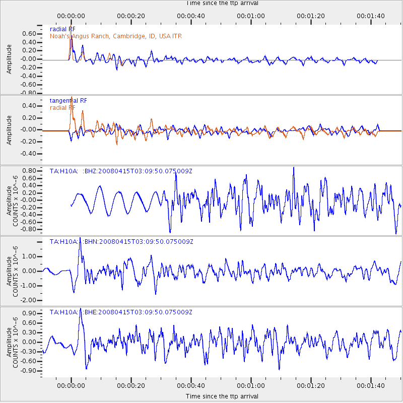
H10A Noah's Angus Ranch, Cambridge, ID, USA - Earthquake Result Viewer
*The percent match for this event was below the threshold and hence no stack was calculated.
| Earthquake location: |
Near Coast Of Guatemala |
| Earthquake latitude/longitude: |
13.6/-90.6 |
| Earthquake time(UTC): |
2008/04/15 (106) 03:03:04 GMT |
| Earthquake Depth: |
33 km |
| Earthquake Magnitude: |
5.6 MB, 5.8 MS, 6.1 MW, 6.1 MW |
| Earthquake Catalog/Contributor: |
WHDF/NEIC |
|
| Network: |
TA USArray Transportable Network (new EarthScope stations) |
| Station: |
H10A Noah's Angus Ranch, Cambridge, ID, USA |
| Lat/Lon: |
44.59 N/116.75 W |
| Elevation: |
882 m |
|
| Distance: |
38.1 deg |
| Az: |
329.326 deg |
| Baz: |
136.027 deg |
| Ray Param: |
$rayparam |
*The percent match for this event was below the threshold and hence was not used in the summary stack. |
|
| Radial Match: |
74.08183 % |
| Radial Bump: |
400 |
| Transverse Match: |
46.463123 % |
| Transverse Bump: |
400 |
| SOD ConfigId: |
2504 |
| Insert Time: |
2010-03-07 04:18:48.680 +0000 |
| GWidth: |
2.5 |
| Max Bumps: |
400 |
| Tol: |
0.001 |
|
Signal To Noise
| Channel | StoN | STA | LTA |
| TA:H10A: :BHN:20080415T03:09:50.075009Z | 6.1120095 | 9.88256E-7 | 1.6169086E-7 |
| TA:H10A: :BHE:20080415T03:09:50.075009Z | 1.9013202 | 4.5036677E-7 | 2.3687055E-7 |
| TA:H10A: :BHZ:20080415T03:09:50.075009Z | 1.512244 | 3.2582236E-7 | 2.1545621E-7 |
| Arrivals |
| Ps | |
| PpPs | |
| PsPs/PpSs | |


