You are here: Home > Network List > TA - USArray Transportable Network (new EarthScope stations) Stations List
> Station HELL Mitchell Peak, Miramonte, CA, USA > Earthquake Result Viewer
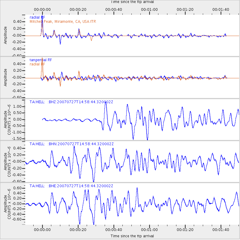
HELL Mitchell Peak, Miramonte, CA, USA - Earthquake Result Viewer

| Earthquake location: |
Southeast Of Loyalty Islands |
| Earthquake latitude/longitude: |
-21.5/170.9 |
| Earthquake time(UTC): |
2007/07/27 (208) 14:46:26 GMT |
| Earthquake Depth: |
10 km |
| Earthquake Magnitude: |
6.0 MB, 6.0 MS, 6.1 MW, 6.1 MW |
| Earthquake Catalog/Contributor: |
WHDF/NEIC |
|
| Network: |
TA USArray Transportable Network (new EarthScope stations) |
| Station: |
HELL Mitchell Peak, Miramonte, CA, USA |
| Lat/Lon: |
36.68 N/119.02 W |
| Elevation: |
1145 m |
|
| Distance: |
87.7 deg |
| Az: |
49.129 deg |
| Baz: |
241.19 deg |
| Ray Param: |
0.04310089 |
| Estimated Moho Depth: |
65.5 km |
| Estimated Crust Vp/Vs: |
1.62 |
| Assumed Crust Vp: |
6.291 km/s |
| Estimated Crust Vs: |
3.872 km/s |
| Estimated Crust Poisson's Ratio: |
0.20 |
|
| Radial Match: |
95.50693 % |
| Radial Bump: |
285 |
| Transverse Match: |
82.8335 % |
| Transverse Bump: |
400 |
| SOD ConfigId: |
2564 |
| Insert Time: |
2010-03-07 04:20:44.411 +0000 |
| GWidth: |
2.5 |
| Max Bumps: |
400 |
| Tol: |
0.001 |
|
Signal To Noise
| Channel | StoN | STA | LTA |
| TA:HELL: :BHN:20070727T14:58:44.320002Z | 2.0062273 | 8.658839E-8 | 4.315981E-8 |
| TA:HELL: :BHE:20070727T14:58:44.320002Z | 4.545528 | 1.3009132E-7 | 2.861963E-8 |
| TA:HELL: :BHZ:20070727T14:58:44.320002Z | 5.5961566 | 3.016657E-7 | 5.390587E-8 |
| Arrivals |
| Ps | 6.7 SECOND |
| PpPs | 27 SECOND |
| PsPs/PpSs | 33 SECOND |


