You are here: Home > Network List > TA - USArray Transportable Network (new EarthScope stations) Stations List
> Station F21K Alatna River, AK, USA > Earthquake Result Viewer
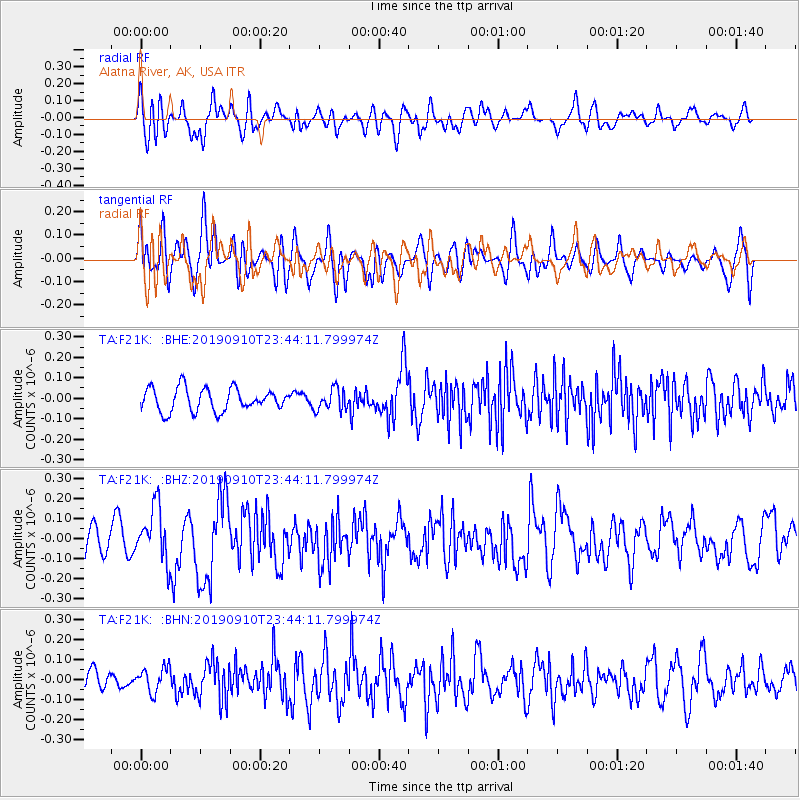
F21K Alatna River, AK, USA - Earthquake Result Viewer
*The percent match for this event was below the threshold and hence no stack was calculated.
| Earthquake location: |
Talaud Islands, Indonesia |
| Earthquake latitude/longitude: |
4.0/126.7 |
| Earthquake time(UTC): |
2019/09/10 (253) 23:32:23 GMT |
| Earthquake Depth: |
24 km |
| Earthquake Magnitude: |
5.6 Mww |
| Earthquake Catalog/Contributor: |
NEIC PDE/us |
|
| Network: |
TA USArray Transportable Network (new EarthScope stations) |
| Station: |
F21K Alatna River, AK, USA |
| Lat/Lon: |
67.22 N/153.48 W |
| Elevation: |
597 m |
|
| Distance: |
82.4 deg |
| Az: |
22.747 deg |
| Baz: |
262.156 deg |
| Ray Param: |
$rayparam |
*The percent match for this event was below the threshold and hence was not used in the summary stack. |
|
| Radial Match: |
57.021214 % |
| Radial Bump: |
400 |
| Transverse Match: |
59.355515 % |
| Transverse Bump: |
400 |
| SOD ConfigId: |
19053131 |
| Insert Time: |
2019-09-24 23:36:17.430 +0000 |
| GWidth: |
2.5 |
| Max Bumps: |
400 |
| Tol: |
0.001 |
|
Signal To Noise
| Channel | StoN | STA | LTA |
| TA:F21K: :BHZ:20190910T23:44:11.799974Z | 1.5813104 | 1.3684034E-7 | 8.653604E-8 |
| TA:F21K: :BHN:20190910T23:44:11.799974Z | 1.202484 | 6.064719E-8 | 5.0434924E-8 |
| TA:F21K: :BHE:20190910T23:44:11.799974Z | 0.94852906 | 5.2917446E-8 | 5.5788956E-8 |
| Arrivals |
| Ps | |
| PpPs | |
| PsPs/PpSs | |


