You are here: Home > Network List > IW - Intermountain West Stations List
> Station MOOW Moose Ponds, Wyoming, USA > Earthquake Result Viewer
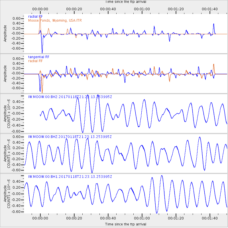
MOOW Moose Ponds, Wyoming, USA - Earthquake Result Viewer
*The percent match for this event was below the threshold and hence no stack was calculated.
| Earthquake location: |
Hawaii |
| Earthquake latitude/longitude: |
21.6/-157.5 |
| Earthquake time(UTC): |
2017/01/18 (018) 21:15:34 GMT |
| Earthquake Depth: |
15 km |
| Earthquake Magnitude: |
2.7 Ml |
| Earthquake Catalog/Contributor: |
NEIC PDE/hv |
|
| Network: |
IW Intermountain West |
| Station: |
MOOW Moose Ponds, Wyoming, USA |
| Lat/Lon: |
43.75 N/110.74 W |
| Elevation: |
2128 m |
|
| Distance: |
44.4 deg |
| Az: |
48.946 deg |
| Baz: |
255.566 deg |
| Ray Param: |
$rayparam |
*The percent match for this event was below the threshold and hence was not used in the summary stack. |
|
| Radial Match: |
65.95649 % |
| Radial Bump: |
280 |
| Transverse Match: |
71.37639 % |
| Transverse Bump: |
400 |
| SOD ConfigId: |
1943534 |
| Insert Time: |
2017-02-01 21:24:28.436 +0000 |
| GWidth: |
2.5 |
| Max Bumps: |
400 |
| Tol: |
0.001 |
|
Signal To Noise
| Channel | StoN | STA | LTA |
| IW:MOOW:00:BHZ:20170118T21:23:13.253995Z | 1.8857179 | 3.0178725E-7 | 1.600384E-7 |
| IW:MOOW:00:BH1:20170118T21:23:13.253995Z | 0.920457 | 2.8212506E-7 | 3.0650543E-7 |
| IW:MOOW:00:BH2:20170118T21:23:13.253995Z | 2.3019176 | 4.5207915E-7 | 1.9639242E-7 |
| Arrivals |
| Ps | |
| PpPs | |
| PsPs/PpSs | |


