You are here: Home > Network List > US - United States National Seismic Network Stations List
> Station MSO Missoula, Montana, USA > Earthquake Result Viewer
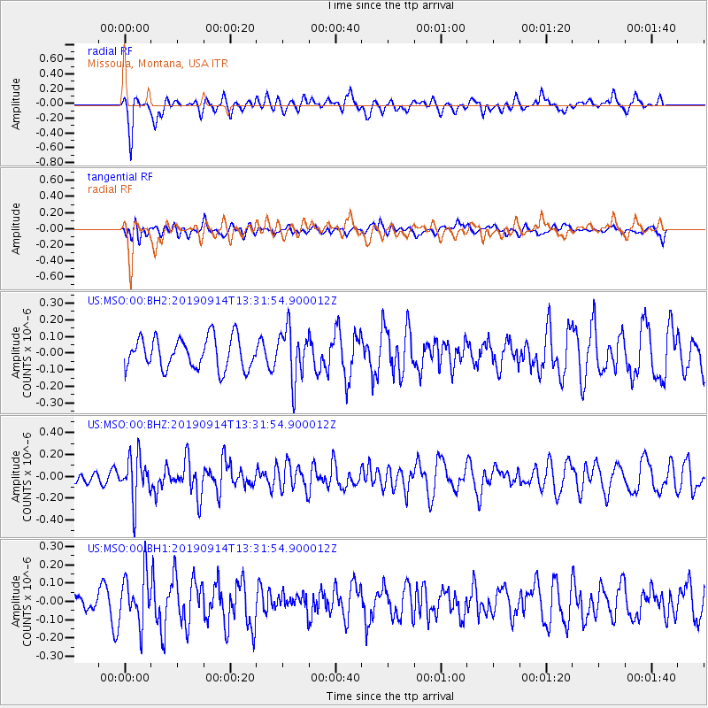
MSO Missoula, Montana, USA - Earthquake Result Viewer
*The percent match for this event was below the threshold and hence no stack was calculated.
| Earthquake location: |
Fox Islands, Aleutian Islands |
| Earthquake latitude/longitude: |
54.0/-165.9 |
| Earthquake time(UTC): |
2019/09/14 (257) 13:25:55 GMT |
| Earthquake Depth: |
73 km |
| Earthquake Magnitude: |
5.4 Mww |
| Earthquake Catalog/Contributor: |
NEIC PDE/us |
|
| Network: |
US United States National Seismic Network |
| Station: |
MSO Missoula, Montana, USA |
| Lat/Lon: |
46.83 N/113.94 W |
| Elevation: |
1264 m |
|
| Distance: |
33.2 deg |
| Az: |
80.748 deg |
| Baz: |
301.896 deg |
| Ray Param: |
$rayparam |
*The percent match for this event was below the threshold and hence was not used in the summary stack. |
|
| Radial Match: |
70.63029 % |
| Radial Bump: |
400 |
| Transverse Match: |
36.84838 % |
| Transverse Bump: |
400 |
| SOD ConfigId: |
19053131 |
| Insert Time: |
2019-09-28 13:35:19.070 +0000 |
| GWidth: |
2.5 |
| Max Bumps: |
400 |
| Tol: |
0.001 |
|
Signal To Noise
| Channel | StoN | STA | LTA |
| US:MSO:00:BHZ:20190914T13:31:54.900012Z | 2.5158384 | 2.0365898E-7 | 8.095074E-8 |
| US:MSO:00:BH1:20190914T13:31:54.900012Z | 2.1690838 | 1.3623033E-7 | 6.280547E-8 |
| US:MSO:00:BH2:20190914T13:31:54.900012Z | 1.6587523 | 1.5449837E-7 | 9.31413E-8 |
| Arrivals |
| Ps | |
| PpPs | |
| PsPs/PpSs | |


