You are here: Home > Network List > US - United States National Seismic Network Stations List
> Station HLID Hailey, Idaho, USA > Earthquake Result Viewer
HLID Hailey, Idaho, USA - Earthquake Result Viewer
*The percent match for this event was below the threshold and hence no stack was calculated.
| Earthquake location: |
Hawaii |
| Earthquake latitude/longitude: |
21.6/-157.5 |
| Earthquake time(UTC): |
2017/01/18 (018) 21:15:34 GMT |
| Earthquake Depth: |
15 km |
| Earthquake Magnitude: |
2.7 Ml |
| Earthquake Catalog/Contributor: |
NEIC PDE/hv |
|
| Network: |
US United States National Seismic Network |
| Station: |
HLID Hailey, Idaho, USA |
| Lat/Lon: |
43.56 N/114.41 W |
| Elevation: |
1772 m |
|
| Distance: |
41.8 deg |
| Az: |
48.134 deg |
| Baz: |
252.448 deg |
| Ray Param: |
$rayparam |
*The percent match for this event was below the threshold and hence was not used in the summary stack. |
|
| Radial Match: |
65.84272 % |
| Radial Bump: |
310 |
| Transverse Match: |
60.99515 % |
| Transverse Bump: |
287 |
| SOD ConfigId: |
1943534 |
| Insert Time: |
2017-02-01 21:25:56.923 +0000 |
| GWidth: |
2.5 |
| Max Bumps: |
400 |
| Tol: |
0.001 |
|
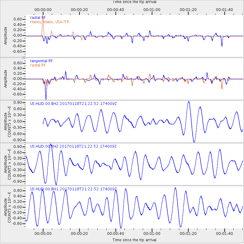
Signal To Noise
| Channel | StoN | STA | LTA |
| US:HLID:00:BHZ:20170118T21:22:52.174009Z | 2.5558257 | 7.175922E-7 | 2.8076727E-7 |
| US:HLID:00:BH1:20170118T21:22:52.174009Z | 0.9437054 | 4.2351152E-7 | 4.4877515E-7 |
| US:HLID:00:BH2:20170118T21:22:52.174009Z | 1.9509201 | 3.6314813E-7 | 1.8614197E-7 |
| Arrivals |
| Ps | |
| PpPs | |
| PsPs/PpSs | |


