You are here: Home > Network List > IC - New China Digital Seismograph Network Stations List
> Station KMI Kunming, Yunnan Province, China > Earthquake Result Viewer
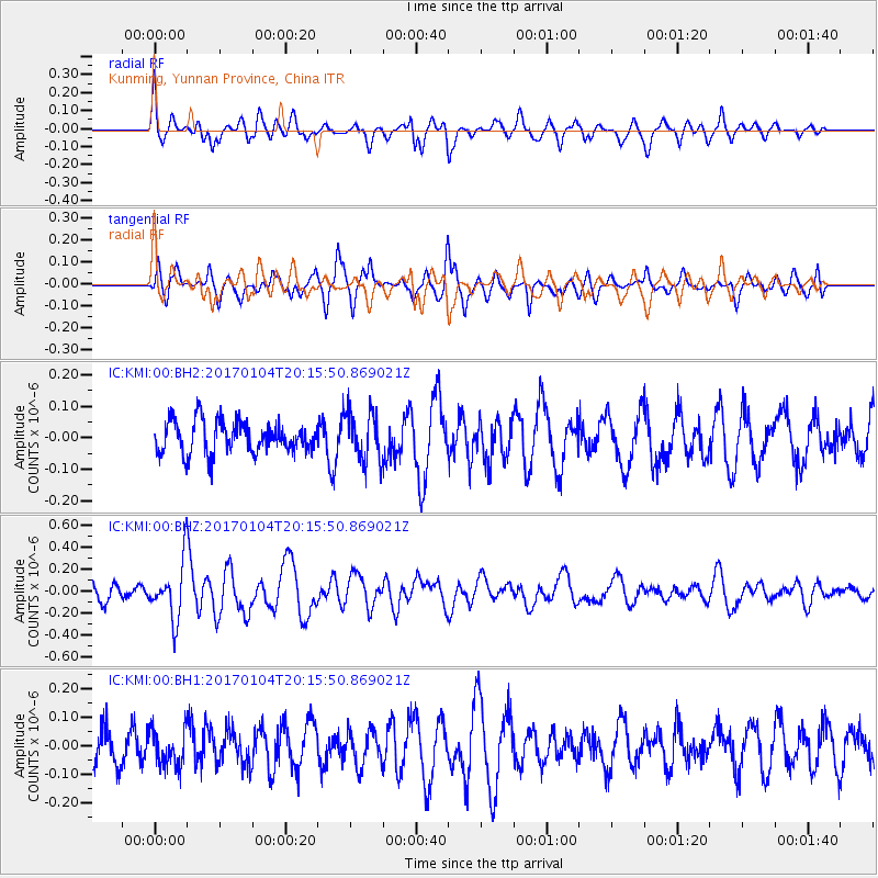
KMI Kunming, Yunnan Province, China - Earthquake Result Viewer
*The percent match for this event was below the threshold and hence no stack was calculated.
| Earthquake location: |
Fiji Islands Region |
| Earthquake latitude/longitude: |
-18.8/176.3 |
| Earthquake time(UTC): |
2017/01/04 (004) 20:03:52 GMT |
| Earthquake Depth: |
7.0 km |
| Earthquake Magnitude: |
5.7 Mww |
| Earthquake Catalog/Contributor: |
NEIC PDE/us |
|
| Network: |
IC New China Digital Seismograph Network |
| Station: |
KMI Kunming, Yunnan Province, China |
| Lat/Lon: |
25.12 N/102.74 E |
| Elevation: |
1975 m |
|
| Distance: |
83.8 deg |
| Az: |
299.027 deg |
| Baz: |
113.965 deg |
| Ray Param: |
$rayparam |
*The percent match for this event was below the threshold and hence was not used in the summary stack. |
|
| Radial Match: |
69.2867 % |
| Radial Bump: |
400 |
| Transverse Match: |
68.10792 % |
| Transverse Bump: |
329 |
| SOD ConfigId: |
1943534 |
| Insert Time: |
2017-02-02 06:57:07.073 +0000 |
| GWidth: |
2.5 |
| Max Bumps: |
400 |
| Tol: |
0.001 |
|
Signal To Noise
| Channel | StoN | STA | LTA |
| IC:KMI:00:BHZ:20170104T20:15:50.869021Z | 2.9300113 | 2.5700294E-7 | 8.771397E-8 |
| IC:KMI:00:BH1:20170104T20:15:50.869021Z | 1.2620883 | 6.22912E-8 | 4.935566E-8 |
| IC:KMI:00:BH2:20170104T20:15:50.869021Z | 1.5611557 | 7.8419546E-8 | 5.023173E-8 |
| Arrivals |
| Ps | |
| PpPs | |
| PsPs/PpSs | |


