You are here: Home > Network List > US - United States National Seismic Network Stations List
> Station DUG Dugway, Tooele County, Utah, USA > Earthquake Result Viewer
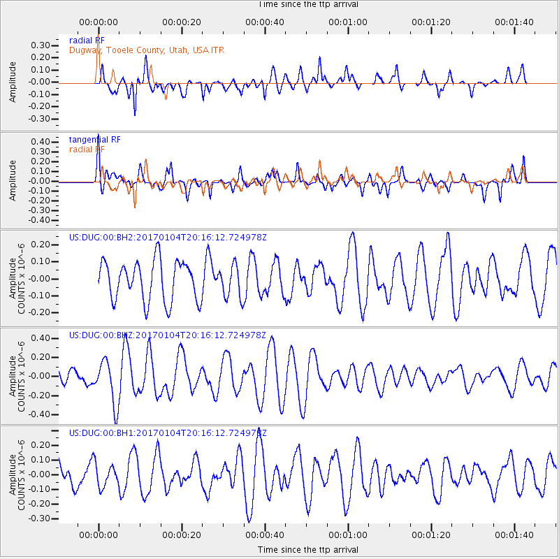
DUG Dugway, Tooele County, Utah, USA - Earthquake Result Viewer
*The percent match for this event was below the threshold and hence no stack was calculated.
| Earthquake location: |
Fiji Islands Region |
| Earthquake latitude/longitude: |
-18.8/176.3 |
| Earthquake time(UTC): |
2017/01/04 (004) 20:03:52 GMT |
| Earthquake Depth: |
7.0 km |
| Earthquake Magnitude: |
5.7 Mww |
| Earthquake Catalog/Contributor: |
NEIC PDE/us |
|
| Network: |
US United States National Seismic Network |
| Station: |
DUG Dugway, Tooele County, Utah, USA |
| Lat/Lon: |
40.19 N/112.81 W |
| Elevation: |
1477 m |
|
| Distance: |
88.2 deg |
| Az: |
46.411 deg |
| Baz: |
243.609 deg |
| Ray Param: |
$rayparam |
*The percent match for this event was below the threshold and hence was not used in the summary stack. |
|
| Radial Match: |
58.463264 % |
| Radial Bump: |
396 |
| Transverse Match: |
58.227066 % |
| Transverse Bump: |
400 |
| SOD ConfigId: |
1943534 |
| Insert Time: |
2017-02-02 06:58:16.767 +0000 |
| GWidth: |
2.5 |
| Max Bumps: |
400 |
| Tol: |
0.001 |
|
Signal To Noise
| Channel | StoN | STA | LTA |
| US:DUG:00:BHZ:20170104T20:16:12.724978Z | 2.2904775 | 2.375031E-7 | 1.0369153E-7 |
| US:DUG:00:BH1:20170104T20:16:12.724978Z | 0.77904046 | 7.16076E-8 | 9.191769E-8 |
| US:DUG:00:BH2:20170104T20:16:12.724978Z | 0.83314335 | 9.7384444E-8 | 1.1688798E-7 |
| Arrivals |
| Ps | |
| PpPs | |
| PsPs/PpSs | |


