You are here: Home > Network List > TA - USArray Transportable Network (new EarthScope stations) Stations List
> Station E20K Nigu River, AK, USA > Earthquake Result Viewer
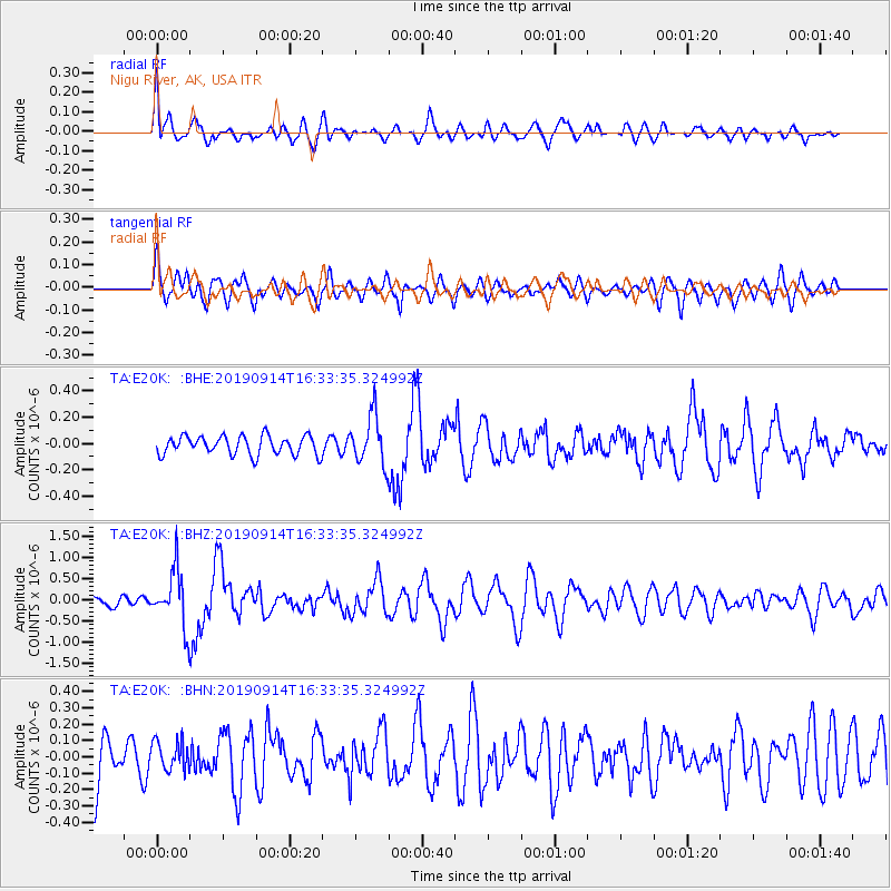
E20K Nigu River, AK, USA - Earthquake Result Viewer
*The percent match for this event was below the threshold and hence no stack was calculated.
| Earthquake location: |
Halmahera, Indonesia |
| Earthquake latitude/longitude: |
-1.0/128.5 |
| Earthquake time(UTC): |
2019/09/14 (257) 16:21:29 GMT |
| Earthquake Depth: |
10 km |
| Earthquake Magnitude: |
5.9 Mww |
| Earthquake Catalog/Contributor: |
NEIC PDE/us |
|
| Network: |
TA USArray Transportable Network (new EarthScope stations) |
| Station: |
E20K Nigu River, AK, USA |
| Lat/Lon: |
68.26 N/156.19 W |
| Elevation: |
866 m |
|
| Distance: |
85.5 deg |
| Az: |
21.19 deg |
| Baz: |
255.935 deg |
| Ray Param: |
$rayparam |
*The percent match for this event was below the threshold and hence was not used in the summary stack. |
|
| Radial Match: |
71.60784 % |
| Radial Bump: |
400 |
| Transverse Match: |
61.23388 % |
| Transverse Bump: |
400 |
| SOD ConfigId: |
19053131 |
| Insert Time: |
2019-09-28 16:26:41.703 +0000 |
| GWidth: |
2.5 |
| Max Bumps: |
400 |
| Tol: |
0.001 |
|
Signal To Noise
| Channel | StoN | STA | LTA |
| TA:E20K: :BHZ:20190914T16:33:35.324992Z | 3.8133135 | 6.5900355E-7 | 1.7281651E-7 |
| TA:E20K: :BHN:20190914T16:33:35.324992Z | 0.5929216 | 8.682994E-8 | 1.4644422E-7 |
| TA:E20K: :BHE:20190914T16:33:35.324992Z | 2.602462 | 1.8484558E-7 | 7.102719E-8 |
| Arrivals |
| Ps | |
| PpPs | |
| PsPs/PpSs | |


