You are here: Home > Network List > TA - USArray Transportable Network (new EarthScope stations) Stations List
> Station N25A Grover, CO, USA > Earthquake Result Viewer
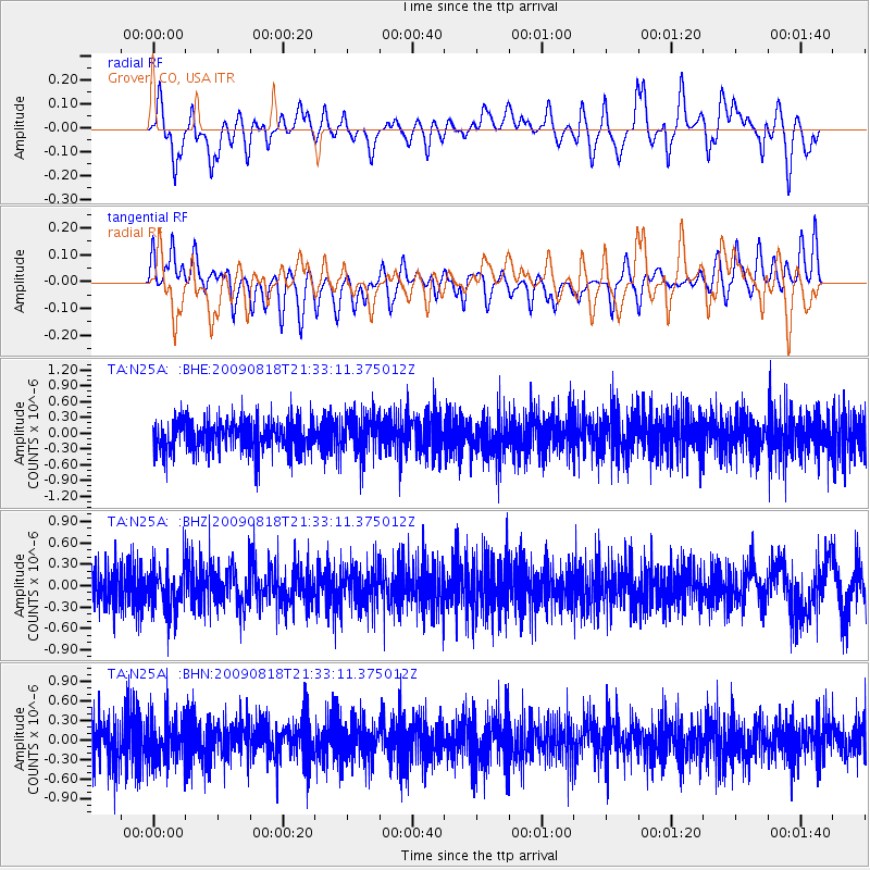
N25A Grover, CO, USA - Earthquake Result Viewer
*The percent match for this event was below the threshold and hence no stack was calculated.
| Earthquake location: |
South Of Fiji Islands |
| Earthquake latitude/longitude: |
-26.1/-178.4 |
| Earthquake time(UTC): |
2009/08/18 (230) 21:20:47 GMT |
| Earthquake Depth: |
270 km |
| Earthquake Magnitude: |
5.5 MB, 6.3 MW, 6.3 MW |
| Earthquake Catalog/Contributor: |
WHDF/NEIC |
|
| Network: |
TA USArray Transportable Network (new EarthScope stations) |
| Station: |
N25A Grover, CO, USA |
| Lat/Lon: |
40.81 N/104.09 W |
| Elevation: |
1607 m |
|
| Distance: |
95.7 deg |
| Az: |
47.254 deg |
| Baz: |
240.49 deg |
| Ray Param: |
$rayparam |
*The percent match for this event was below the threshold and hence was not used in the summary stack. |
|
| Radial Match: |
51.94127 % |
| Radial Bump: |
400 |
| Transverse Match: |
40.104507 % |
| Transverse Bump: |
400 |
| SOD ConfigId: |
2622 |
| Insert Time: |
2010-03-07 04:25:52.174 +0000 |
| GWidth: |
2.5 |
| Max Bumps: |
400 |
| Tol: |
0.001 |
|
Signal To Noise
| Channel | StoN | STA | LTA |
| TA:N25A: :BHZ:20090818T21:33:11.375012Z | 1.0253391 | 2.9490607E-7 | 2.876181E-7 |
| TA:N25A: :BHN:20090818T21:33:11.375012Z | 0.97429264 | 3.4099955E-7 | 3.4999707E-7 |
| TA:N25A: :BHE:20090818T21:33:11.375012Z | 1.2374336 | 3.742517E-7 | 3.0244186E-7 |
| Arrivals |
| Ps | |
| PpPs | |
| PsPs/PpSs | |


