You are here: Home > Network List > TA - USArray Transportable Network (new EarthScope stations) Stations List
> Station N25A Grover, CO, USA > Earthquake Result Viewer
N25A Grover, CO, USA - Earthquake Result Viewer
*The percent match for this event was below the threshold and hence no stack was calculated.
| Earthquake location: |
Kuril Islands |
| Earthquake latitude/longitude: |
48.3/154.2 |
| Earthquake time(UTC): |
2009/09/10 (253) 02:46:50 GMT |
| Earthquake Depth: |
36 km |
| Earthquake Magnitude: |
6.0 MB, 5.5 MS, 6.0 MW, 5.8 MW |
| Earthquake Catalog/Contributor: |
WHDF/NEIC |
|
| Network: |
TA USArray Transportable Network (new EarthScope stations) |
| Station: |
N25A Grover, CO, USA |
| Lat/Lon: |
40.81 N/104.09 W |
| Elevation: |
1607 m |
|
| Distance: |
67.5 deg |
| Az: |
53.526 deg |
| Baz: |
314.994 deg |
| Ray Param: |
$rayparam |
*The percent match for this event was below the threshold and hence was not used in the summary stack. |
|
| Radial Match: |
74.673195 % |
| Radial Bump: |
400 |
| Transverse Match: |
76.01612 % |
| Transverse Bump: |
400 |
| SOD ConfigId: |
2622 |
| Insert Time: |
2010-03-07 04:25:53.797 +0000 |
| GWidth: |
2.5 |
| Max Bumps: |
400 |
| Tol: |
0.001 |
|
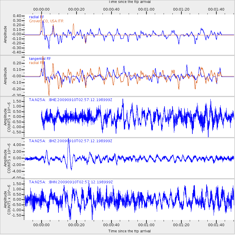
Signal To Noise
| Channel | StoN | STA | LTA |
| TA:N25A: :BHZ:20090910T02:57:12.198999Z | 3.0037723 | 1.065576E-6 | 3.54746E-7 |
| TA:N25A: :BHN:20090910T02:57:12.198999Z | 1.0595059 | 4.804162E-7 | 4.5343415E-7 |
| TA:N25A: :BHE:20090910T02:57:12.198999Z | 1.376205 | 4.933859E-7 | 3.5851195E-7 |
| Arrivals |
| Ps | |
| PpPs | |
| PsPs/PpSs | |


