
J10A Berg Farm, Melba ID, USA - Earthquake Result Viewer
| ||||||||||||||||||
| ||||||||||||||||||
| ||||||||||||||||||
|
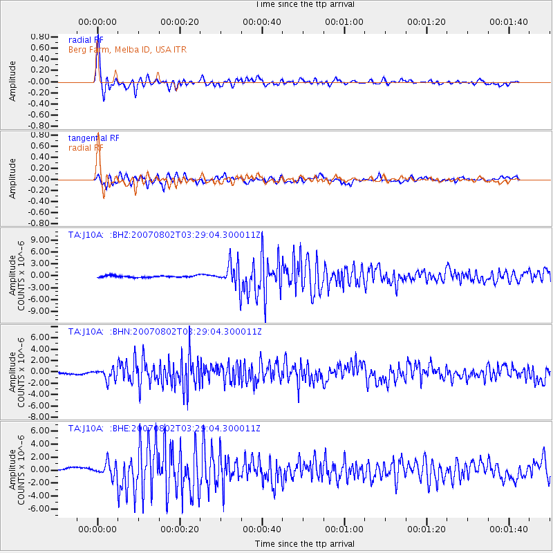
Signal To Noise
| Channel | StoN | STA | LTA |
| TA:J10A: :BHN:20070802T03:29:04.300011Z | 3.507315 | 1.0068234E-6 | 2.8706387E-7 |
| TA:J10A: :BHE:20070802T03:29:04.300011Z | 1.7135726 | 1.0880781E-6 | 6.3497635E-7 |
| TA:J10A: :BHZ:20070802T03:29:04.300011Z | 14.28632 | 3.1248778E-6 | 2.187322E-7 |
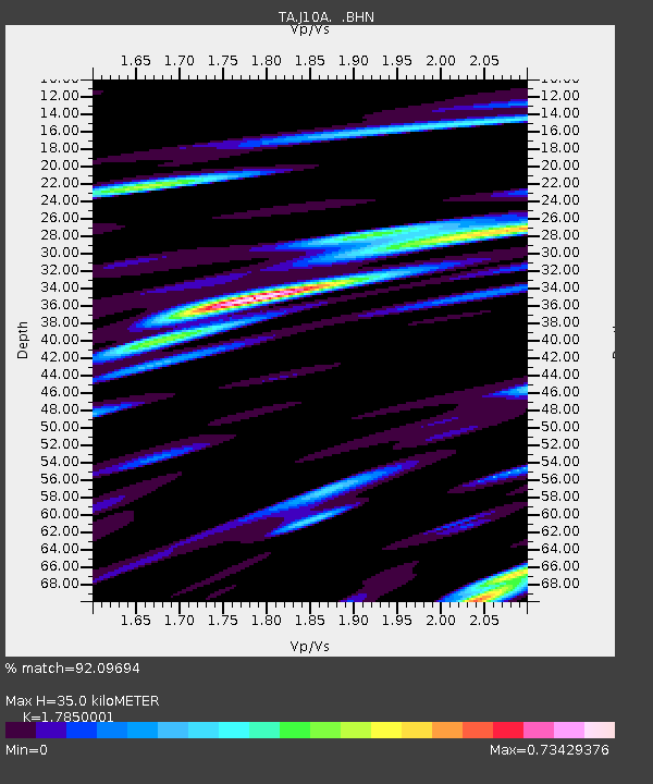
| Arrivals | |
| Ps | 4.7 SECOND |
| PpPs | 15 SECOND |
| PsPs/PpSs | 19 SECOND |

