
J10A Berg Farm, Melba ID, USA - Earthquake Result Viewer
| ||||||||||||||||||
| ||||||||||||||||||
| ||||||||||||||||||
|
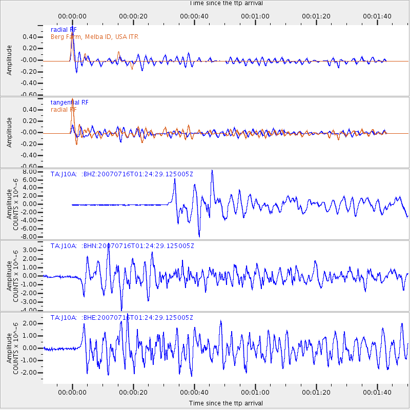
Signal To Noise
| Channel | StoN | STA | LTA |
| TA:J10A: :BHN:20070716T01:24:29.125005Z | 14.393114 | 8.2041305E-7 | 5.7000385E-8 |
| TA:J10A: :BHE:20070716T01:24:29.125005Z | 15.271004 | 7.4206616E-7 | 4.859315E-8 |
| TA:J10A: :BHZ:20070716T01:24:29.125005Z | 62.23551 | 2.3207492E-6 | 3.728979E-8 |
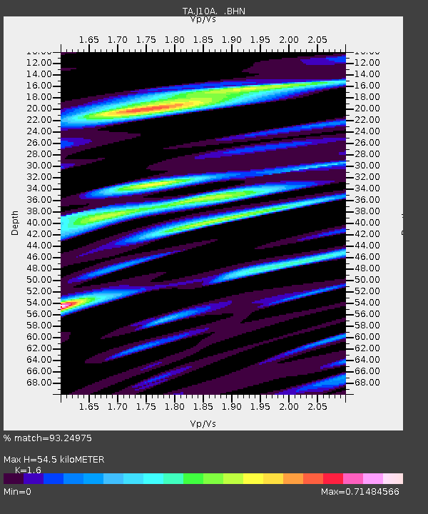
| Arrivals | |
| Ps | 5.4 SECOND |
| PpPs | 22 SECOND |
| PsPs/PpSs | 27 SECOND |

